SAME OLD GAME….do whatever it is you want and then attempt to change the rules and mitigate damages to those innocent victims already harmed.
Check out how support for this proposed “administrative change” by the STATE WATER RESOURCES CONTROL BOARD (SWRCB aka “STATE WATER BOARD”) was initiated and why.
Should not such a request have been forwarded to the SWRCB PRIOR TO ANNEXING properties into the LDPCSD that were clearly outside the POU of WL11395?
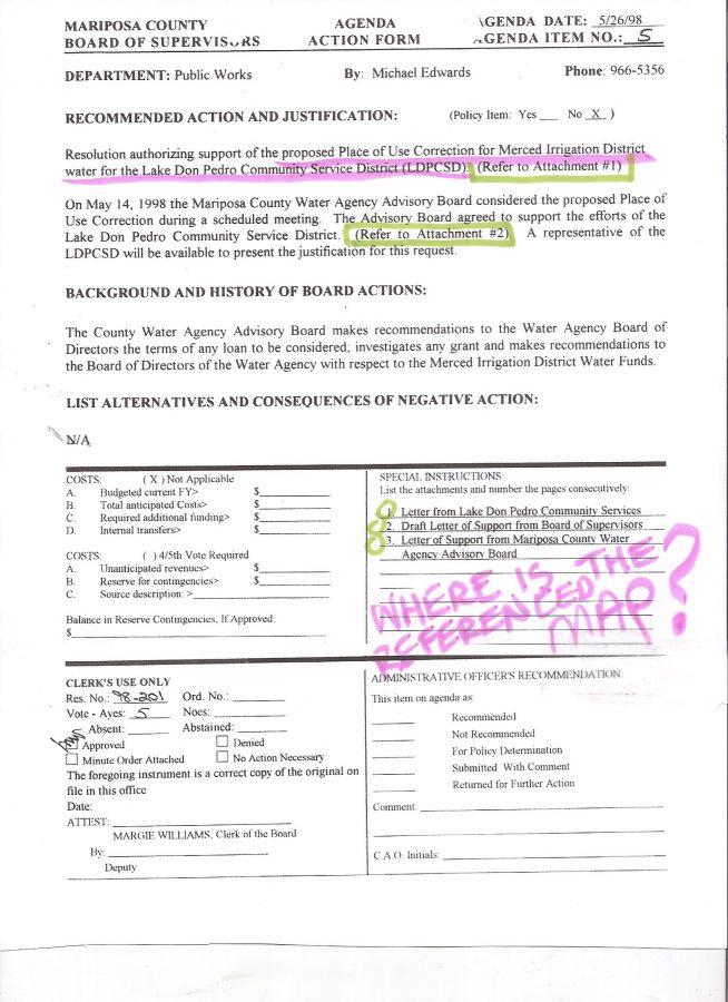
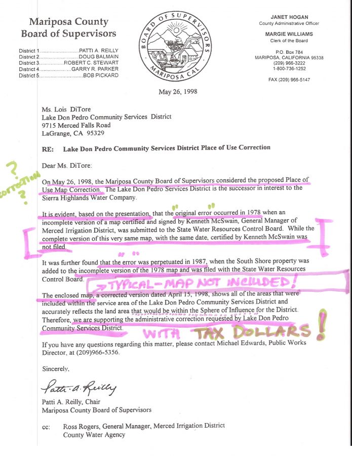
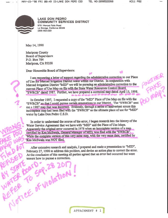
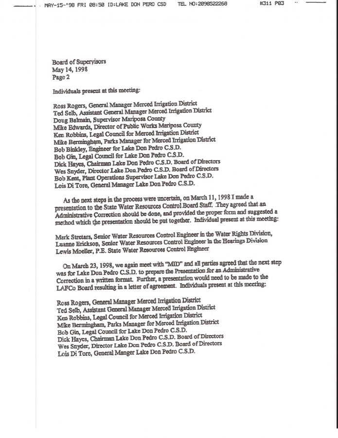
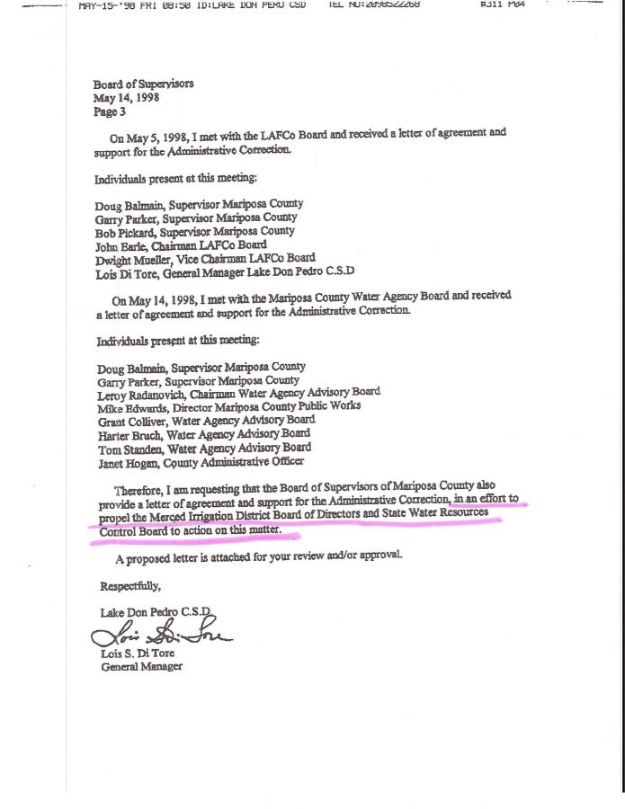
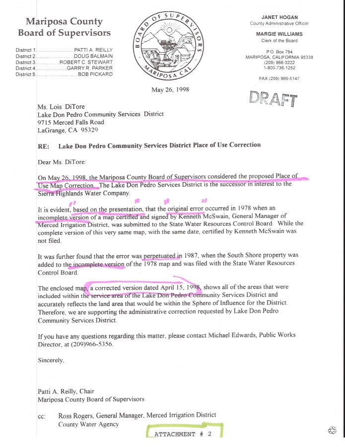
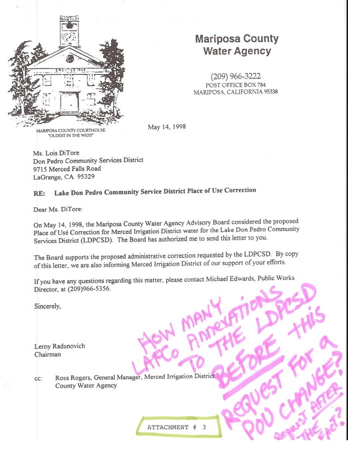
Please also appreciate that once again FALSE INFORMATION WAS BEING USED TO ENCOURAGE OTHERS TO SUPPORT THE CAUSE OF REPLACING THE LEGITIMATE MAP WITH A “FAKE POU MAP” SO AS TO CONTINUE THE EXPANSION OF THE DISTRICT WATER SERVICE BOUNDARIES EVEN FURTHER THAN HAD ALREADY BEEN EXPANDED BY LAFCO!
What is the FALSE INFORMATION BEING CONVEYED?
The WRONG POU MAP had been filed with the State of California instead of the map “KAMPA & KOMPANY” (and his LDPCSD predecessors who advocated district expansion beyond the water license boundary from “day one”) claim was the correct map and included many of the LAFCO ANNEXATIONS into the district that had already started receiving water – not to mention all those which were planned to also be served outside the POU.
Apparently the incorrect June 20, 1977 map which included many LAFCO ANNEXATIONS “reserving water for future use”was indeed filed with the state during licensing yet was later revised June 15, 1998 to remove those areas “reserving water for future use” which were clearly outside the WL1395 POU boundary.
Here are the words from the September 28th, 2017 SWRCB NOTICE OF VIOLATION to the LDPCSD (page 31-32):
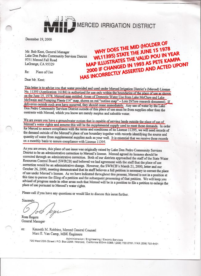
“A review of Division records indicates that issues with the POU on MID’s License 11395 corresponding to the LDPCSD area began in the 1970’s and were discussed by correspondence in 1999 and 2000. By letter dated August 18, 1999, MID requested an administrative change to expand the boundaries of its service area under the license. MID claimed that the boundaries should have included parcels outside of the designated POU, served with water as early as 1973. However, according to MID, these areas were not included in the POU due to MID not submitting a revised map between 1978 and licensing. Division staff produced a memo dated February 23, 2000. The memo indicates that the POU for License 11395 includes “domestic use at homesites with the service area of Sierra Highlands Water Company.” The Sierra Highlands Water Company is the predecessor of the LDPCSD. The memo concludes that the licensed POU purposefully did not include the areas “reserving water for future use”, as shown on the June 20, 1977 map.
MID was informed of the Division’s findings by letter dated March 21, 2000, and the Division advised MID that a change petition was needed to fix the discrepancy in the POU. After subsequent correspondence, MID stated by letter dated December 19, 2000 that LDPCSD is not using water diverted under the MID license outside the POU. Additionally, the letter states, “We believe the use of supplemental supply by the LDPCSD and the associated reporting to Merced by the LDPCSD avoids the need for Merced to file a petition for change pursuant to its water rights.”
PAGE 33:
“Division staff obtained maps of the LDPCSD from Division files and from the LDPCSD website. The website has a side by side display of the 2012 LDPCSD boundaries and the June 20, 1977 map (revised June 15, 1978) submitted to the Division as part of the licensing process, cited in the 1999-2000 correspondence.”
Recall what the result of this orchestrated request for a POU change based on more incorrect information provided by the LDPCSD was?…….
Yet here we are once again in 2018
continuing the same waste and misuse of substantial public funds and resources in another attempt to re-litigate and expand POU BOUNDARIES [changing water license] that were legally established over forty years ago. Why? Special interests want to include properties for Merced River water service despite the fact they are clearly outside the legitimate POU of the entitled residential subdivision.
Appreciate the “DOUBLE WHAMMY” in financial costs and reduced services for MR WECs?
If no POU CHANGE – pursued with local public funds for private land developer interest benefit – then their “fallback position” is simply the continuation of the unethical and EXTREMELY EXPENSIVE SUBSIDIZED GROUNDWATER SUBSTITUTION FOR WRONGFUL MERCED RIVER WATER DIVERSIONS outside the POU of WL11395!
The original Ranchito Drive well #1 has been down for years which means EVERY SINGLE DROP OF GROUNDWATER being used to remedy these intentional violations of the water license (providing water outside the subdivision) has been funded with STATE and FEDERAL GRANT MONEY THAT WAS SPECIFICALLY INTENDED TO ASSIST EXISTING CUSTOMERS THROUGH EMERGENCY DROUGHT CONDITIONS…….NOT TO PROVIDE A SPECIAL FINANCIAL WATER SERVICE BENEFIT TO LAND DEVELOPERS WITH LAFCO ANNEXED LAND OUTSIDE THE SUBDIVISION PLACE OF USE !
I believe such could be considered a misappropriation of government funds if requisite intent could be established.
The MR WECs of the LAKE DON PEDRO residential subdivision have been paying more for their water service since DAY ONE (higher availability fees had to be approved due to low population in subdivision but then that extra revenue was used to pursue further service OUTSIDE THE FRACK’N SUBDIVISION!) because of the intentional failure of the District to abide by the water restrictions contained in WL11395 while simultaneously catering to the special interests of real estate/land developers holding vast areas of land outside the license boundary which required water for development.
Also please remember that the 1987 establishment of a huge SPHERE OF INFLUENCE (SOI) BOUNDARY [where water service might reasonably be provided in the future] was based on a detailed LAFCO commissioned SOI RESEARCH STUDY and Report that……..
NEVER ONCE
MENTIONED THE WATER RESTRICTIONS IN WL11395!
Peculiar, yeah?
My best to you and yours, Lew
PS: Latest request for Public Information:
12:05 (today)
Good afternoon Syndie – hope you had a happy Thanksgiving!
Please accept this email as a PUBLIC INFORMATION REQUEST FOR a copy of the April 15, 1998 LDPCSD Place of Use boundary map.
BACKGROUND: Per the Lake Don Pedro Community Services District (LDPCSD) May 14, 1998 correspondence (composed by then GM Lois S. Di Tore to the Mariposa County Board of Supervisors requesting support for a STATE WATER BOARD Administrative Correction to the water license Place of Use) I hereby request a copy of that LDPCSD prepared April 15, 1998 POU map presented to the Mariposa County Board of Supervisors for their consideration and ultimate action on that matter.
ALSO, I have not received a response to my November 14, 2018 PUBLIC INFORMATION REQUEST for the following documents:
-
A copy of the Official WL11395 POU Map currently on file with the SWRCB;
-
A copy of the LAFCO 1980 formation map derived from the metes and bounds field survey of the proposed LDPCSD service area; and
-
A CD copy of the audio recording of the last LDPCSD special meeting held on November 12, 2018.


