WHY IS AN INVESTIGATION NECESSARY?
Past LDPCSD actions have been based on documents and maps to support those actions. Yet those very records used in support of OFFICIAL ACTIVITY have been subject to selective interpretation, application, and enforcement. Those documents and maps have been subject to unlawful modification, fabrication, theft, burglary, even arson (admin office destroyed in Feb 2012), come to think of it, wasn’t there also a new records retention and destruction policy Kampa got the board to approve? What miserable tiny little scrap of truth and fact remains is circumvented with other fabricated garbage all utilized as evidence in support of management’s reconfiguration and future direction of this district to third party special benefit. Which coincidentally, is in obvious conflict with original founding documents and the intended purpose of the district. Oooops!
Here’s the hook…..the legally entitled customers (99%) pay for it. They started paying back then. They pay now. And KAMPA & KOMPANY is trying to set it up so we pay FOREVER!
They sure are lucky all those records disappeared. Or did they?
Official county records have also been corrupted with bad information apparently originating from whatever management LDPCSD was going through at the time. A real roller coaster through the decades. But here’s the kicker, if the county was deliberately deceived about the facts with all the turmoil, arguing, court hearings, threatened lawsuits and crap for years…..why do they allow it to happened again, and again, and again? Didn’t someone, somewhere in Mariposa County government recognize an obvious pattern of deception by that public service agency? Or was the County itself going through their own “cycle” of who is best to – and knows how to – run this county political garbage? I don’t know, but way beyond my research capabilities. I’m just trying to understand how an exception to the rule in water service has mutated into re configuring our SURFACE WATER TREATMENT PLANT INTO A GROUNDWATER SUBSTITUTION PROGRAM GEARED TO THE SPECIAL INTEREST AND BENEFIT OF THIRD PARTY LAND DEVELOPERS.
Was Mariposa complicit with this plan to subsidize land development with “trapped property owners in the Lake Don Pedro Owners Association residential subdivision”?(and to a much lesser extent Tuolumne County – because at least they drew the line with a “late comer” land development company out of the Bay Area in early 2000 – see? I’m learning)
Where were/are the government oversight “watchdogs” to ensure that the County itself or its citizens weren’t/aren’t getting ripped off somehow? Or exposed to serious liability for knowingly permitting this misrepresentation to continue? (Same as SRA Fire Safe Roadway Regulations being completely ignored by the “late comer developer” – but no action by county to stop or correct?)
Seems to me a methodical inspection as to what LEGITIMATE EVIDENCE REMAINS would be a good starting point. (That is why I am so disgusted that after months of waiting for KAMPA & KOMPANY assurances of action nothing materialized but the KAMPA KRAPA presentation at the September 19th, 2016 monthly Board of Directors meeting. OK. Let’s work with that.
A SERIOUS LEGITIMATE INVESTIGATION IS NECESSARY TO PROTECT LDPOA PROPERTY OWNERS (aka MANDATORY CUSTOMERS OF THE LDPCSD!)
The LAKE DON PEDRO COMMUNITY SERVICES DISTRICT [LDPCSD] is a public agency and subject to the laws of this country, local, State, and Federal. Starting with known regulations and restrictions seems logical.
MULTIPLE AUTHORITIES and JURISDICTIONS
The Counties of Tuolumne and Mariposa regulate and control areas within their respective county jurisdictions. The STATE WATER RESOURCES CONTROL BOARD established how and where that MERCED RIVER WATER could legally be used under water license 11395 held by the MERCED IRRIGATION DISTRICT. Federal government agencies also regulate water issues within this state. Federal regulations also specifically determined how and for what projects public grant funding would be available for public water distribution agencies such as the LDPCSD. Grant funds are not FREE MONEY without “strings attached” (As Wes Barton most recently pointed out at an LDPCSD board meeting). The management company for a designated public agency, that also happens to be a designated disadvantaged community, can not use those funds TO PROVIDE SPECIAL NEW WATER SERVICES OUTSIDE THE MIDPOU.
BUT WHAT IF MERCED RIVER WATER IS USED OUTSIDE THE LEGAL AREA?
Water service with MERCED RIVER WATER outside the legal PLACE OF USE is a violation of the license restrictions yet violations can be remedied through a process called GROUNDWATER SUBSTITUTION FOR SURFACE WATER TRANSFER. (A legal way to actually intentionally circumvent the restrictions in the license.)
MERCED RIVER WATER, which flows from Yosemite National Park and is held or “impounded” in LAKE McClure, is considered “SURFACE WATER” and this is where the LDPCSD has always pumped water for delivery to customers. Every unit of MERCED RIVER WATER (from :McClure) that is delivered “OUTSIDE THE POU” (Place of Use) must be replaced with an equal or greater amount of an “ALTERNATE SOURCE OF WATER” – which is any other water available that is not MERCED RIVER WATER! (lol). For the Lake Don Pedro area this means the use of expensive, and often times unreliable production, of a frequently lower quality groundwater. MERCED RIVER WATER IS SOME OF THE BEST WATER IN THE STATE!
SO, RECAP, every gallon of MERCED RIVER WATER that is delivered OUTSIDE THE LICENSE Place of Use (POU) must be replaced with a gallon of GROUNDWATER.
The LAKE DON PEDRO SURFACE WATER TREATMENT PLANT was specifically created for the LAKE DON PEDRO residential subdivision and operated under MERCED IRRIGATION DISTRICT WATER LICENSE 11395……so-
it should be of
no big surprise
that the
MERCED RIVER WATER PLACE OF USE fits the subdivision boundary like a glove!
Compare the two maps, notice that every time the water license boundary juts in a particular direction that is exactly where you will find a residential neighborhood of the LDP subdivision. Already approved with infrastructure (delivery system pipes, etc) installed. The LDP subdivision is a SHADOW OF THE MID POU.
MAKES SENSE THAT INFRASTRUCTURE WAS INSTALLED, BUT…..
Subdivision infrastructure was installed to deliver MERCED RIVER WATER to each entitled parcel in the subdivision and a few exceptions outside the residential development. But here’s the kicker, the subdivision was originally going to include the two other counties – Stanislaus and Merced, but those plans were abandoned (was this because they were proposing to expand into areas beyond the available water under 11395? Why Boise constructed then abandoned over 12 groundwater wells in an attempt to expand that service yet still could not without sufficient good groundwater?) Making matters worse, some adjacent properties (abandoned from LDPOA inclusion) did have water lines close but could not legally receive the MERCED RIVER WATER pumped from McClure. [Hey, they didn’t want all the subdivision rules, CC&Rs, Board of Directors, annual assessments, blah blah blah…..they wanted out! They got out. But then later they demanded the one BIG SELLING POINT FOR LAKE DON PEDRO PROPERTY ……our water. Go figure.
UNFAIR
The 99% of legally entitled MERCED RIVER WATER USING customers of the subdivision (3,000 +/-) who because of that property ownership are mandatory customers of the LDPCSD, have been FORCED TO SUBSIDIZE A SPECIAL BENEFIT WATER SERVICE FOR PRIVATE LAND DEVELOPER PROJECTS OUTSIDE THE LEGAL PLACE OF USE FOR DECADES. THIS NEEDS TO STOP IMMEDIATELY BECAUSE IT WILL INCREASINGLY GET MORE EXPENSIVE.
SOME INITIAL OBVIOUS QUESTIONS:
WHY DID LAFCo (when forming the new LDPCSD) expand those water service boundaries far beyond that of water license 11395?
WHY DID LAFCo expand the LDPCSD boundaries beyond what the CALIFORNIA PUBLIC UTILITIES COMMISSION approved in the transfer of facilities and assets for that proposed new community services district?
What evidence is there that LAFCo expanded the service boundaries beyond the water license as well as the CPUC transfer approved service boundary?
EVERYONE SAYS THIS IS IT! THE OFFICIAL DOCUMENT DESCRIBING THE LDPCSD WATER SERVICE BOUNDARIES!
(really? Fool me once, shame on you, fool me twice shame on me, fool me multiple times year after year after year…..?
you must be from the government!
lol)
THE INFAMOUS SURVEY
Personally I have a hard time accepting anything as “official” if the document does not contain common sense information one would expect to observe on something used as “evidence” of a particular transaction, process, or project. Even as children we were taught in school to put our name, date, and subject on all homework. High school drafting classes emphasized how the title block of a drawing should always contain project title, date, drafter’s name, revision number, relevant notes, etc.. (Maybe it did? But the original map can’t be found)
This survey seems very suspicious to me considering the importance of the document and how it appears to be in DIRECT CONFLICT with other known and accepted documents such as the water restrictions and the Public Utility Commission’s approval of the service area for the new district.
Basic questions.
A surveyor can only survey what was requested to be surveyed, right?. Someone instructed this individual to use the metes and bounds engineer descriptions for the legal purpose of describing a particular geographical area and establishing a water district.
I doubt the surveyor walked over a hill and said “Oh there’s a nice looking little valley with a seasonal creek, I think I will include it in this new district that the Mariposa County LAFCo is forming”.
WHEN was this survey performed?
WHO paid for the survey?
WHO instructed the surveyor WHAT to survey?
Did LAFCo cause that survey to be made or was it presented as founding information by district supporters?
WHY do service boundaries go beyond what had already been approved by CPUC?
WHY do service boundaries go beyond the license restrictions?
WHERE IS THE ORIGINAL MAP BASED ON THIS SURVEY?
IS THIS EVEN THE ORIGINAL SURVEY OR MERELY ONE SUBSTITUTED FOR THE ORIGINAL?
WHY NOT PROPERLY IDENTIFIED?
(I’m exhausted. I would bet money, marbles or chalk that many of you viewers have thought of better questions. Sorry. I’m beat.)
HERE IS THE INFAMOUS SURVEY
(WITHOUT THE ORIGINAL CORRESPONDING “OFFICIAL SERVICE BOUNDARY MAP” -of course.)
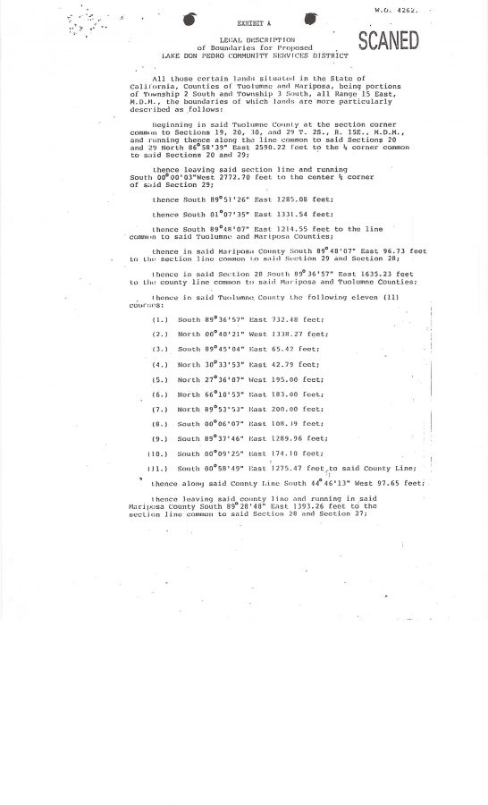
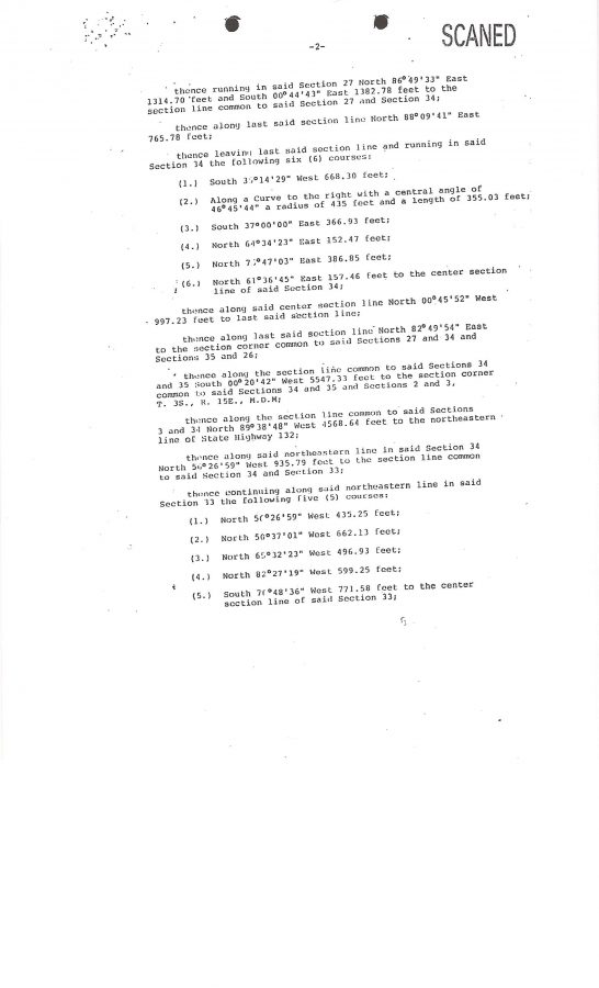

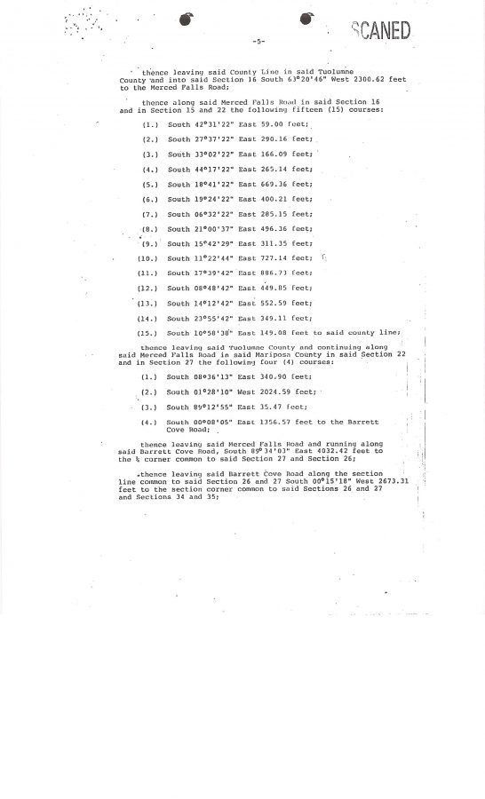

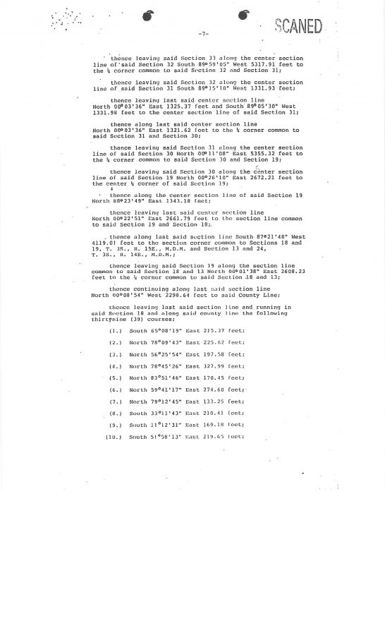

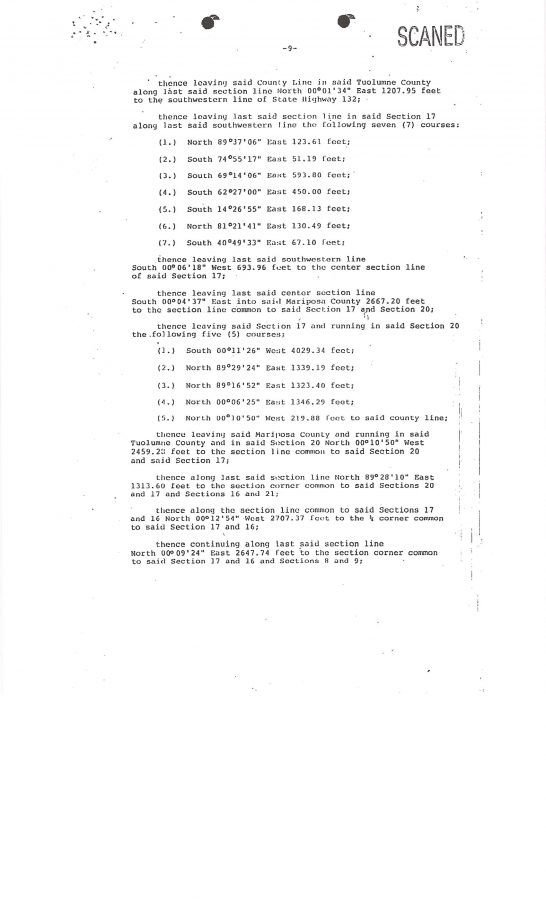
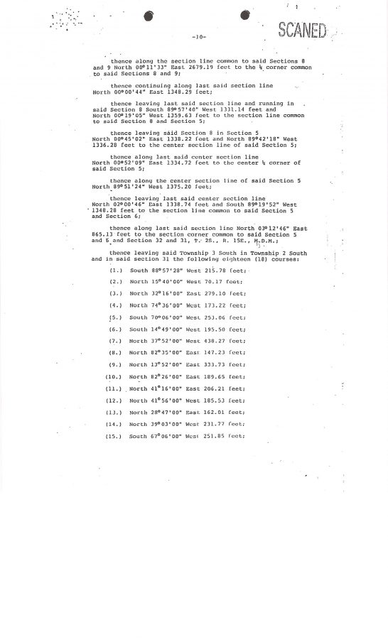
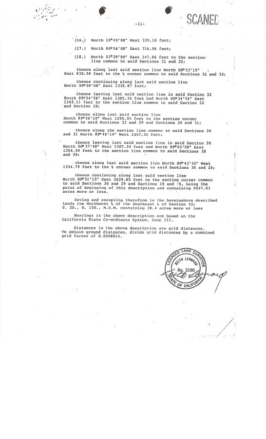

Without the corresponding map, the “metes and bounds” description is not very helpful in locating a particular piece of property to see if it is in the LDPCSD water service boundaries or within the MERCED IRRIGATION DISTRICT PLACE OF USE FOR MERCED RIVER WATER UNDER L11395 – is it?
???????????????????????
While waiting for KAMPA & KOMPANY to burn through thousands of more LDPCSD dollars to re-create a map that should never have been stolen, destroyed, or purposefully concealed in the first place, I decided to attempt gleaning some usable information from all those degrees, numbers, distances, and headings contained in the survey KAMPA & KOMPANY maintains are the LDPCSD’s OFFICIAL SERVICE BOUNDARIES.
BACKGROUND. When I first purchased my LAKE DON PEDRO property in 1990 I wanted to learn as much about this area as I possibly could so I ordered a complete set of available maps for this area. Fascinating information which included identifying Federal and State lands, maps illustrating topographic, geologic, and water features, roads highways, a map of earthquake history (hard to believe how many are confirmed in this area), land uses, agricultural, mining, environment preserves, etc. A bunch of cool maps! About a hundred dollars worth!
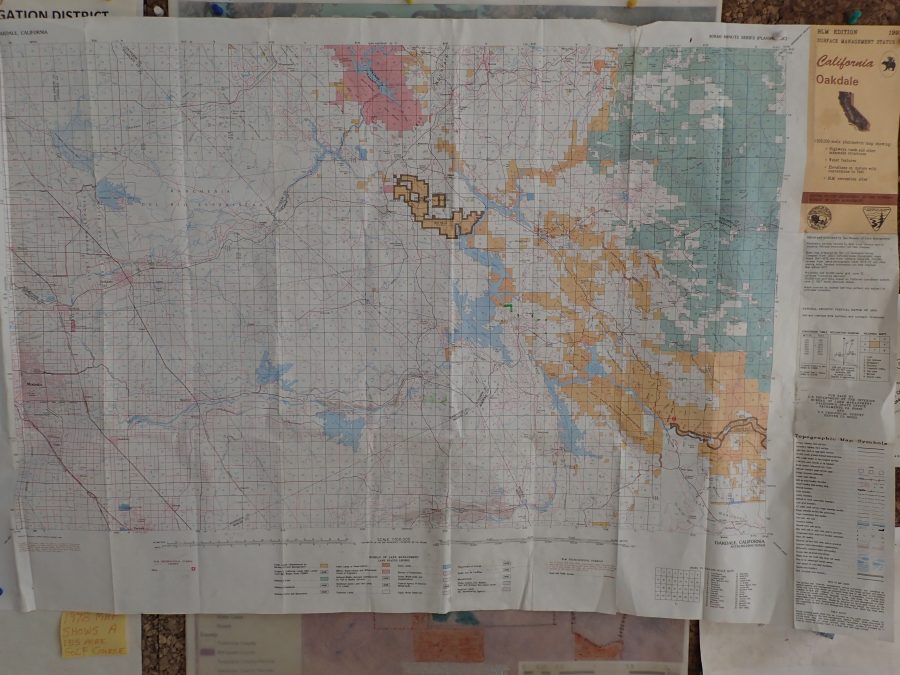
For this little experiment I used a BLM map with defined Township, Range and Section grids.
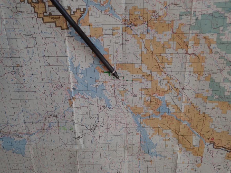
Although I am certainly not an engineer or surveyor, I was able to understand a couple of coordinate descriptions on PAGE TWO OF THE SURVEY. [INSIDE GREEN BOX]
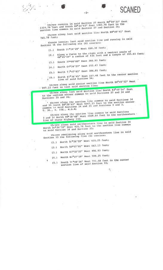
Page 2 of survey
I then sparingly marked these descriptions on the map with a green marker (don’t want to ruin my beautiful map! lol)
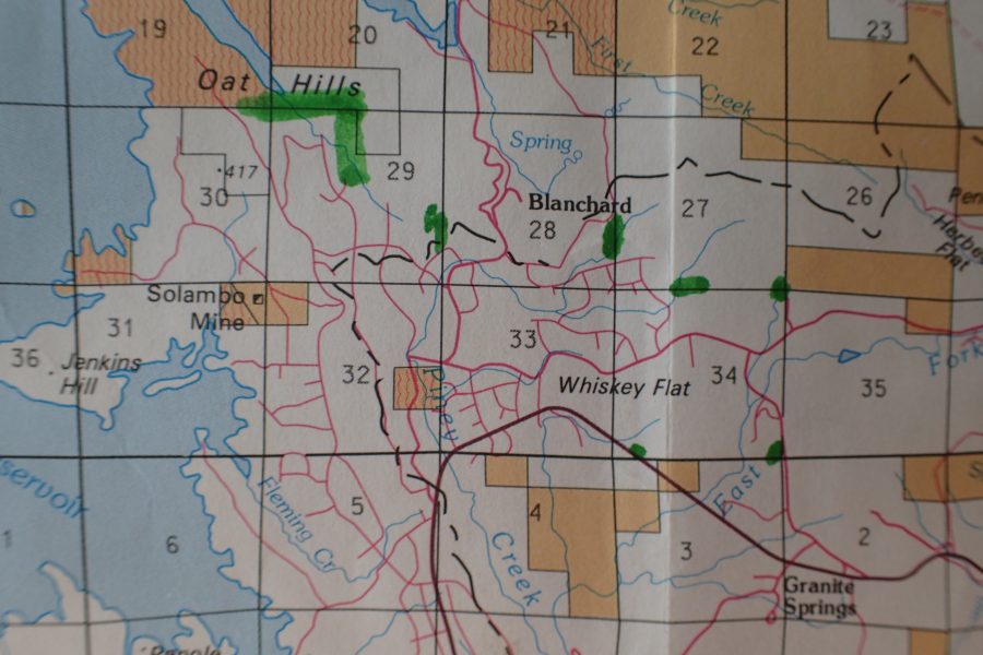
(Above: Sections 34, 35, 2 and 3 marked)
Certainly this survey will indicate property OUTSIDE THE MERCED IRRIGATION DISTRICT PLACE OF USE FOR MERCED RIVER WATER around the Granite Springs area.
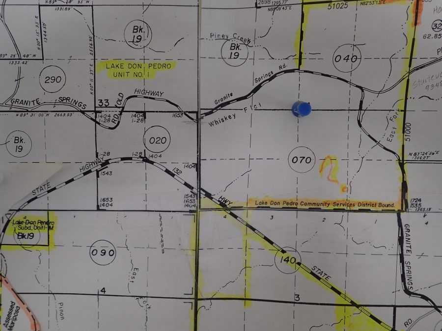
Below is a Mariposa County Map I obtained illustrating the same area with the only notation I could find designating the LDPCSD boundary. None of the properties around the border of the subdivision had this notation.
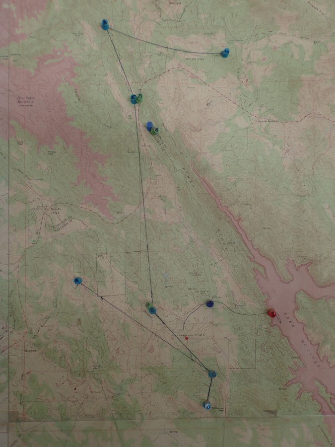
Below is a map identifying locations of LDPCSD water tanks. The Sturtevant tank is the upper far right blue push pin. Notice all the subdivision roads, streets, drives, cul de sacs, etc…..gee, a clue to who was supposed to receive the water?
The Sturtevant tank issue was not a matter of WHERE MERCED RIVER WATER COULD OR WOULD BE SERVED, but rather HOW IT WOULD BE SERVED TO THE ALREADY DESIGNATED LAKE DON PEDRO RESIDENTIAL SUBDIVISION. Just look at the maps. Again, the MID POU fits around the subdivision like a glove. Why did LAFCo (if they indeed had this “peculiar survey” conducted) expand the LDPCSD service boundaries so far? Why wasn’t this Sturtevant property designated SOI (Sphere of Influence) rather than inside the boundary?
I need a break
My best to you and yours, Lew
Just thought of another good blog posting title: “GIVE THEM AN INCH AND THEY WILL STEAL YOUR SURFACE WATER TREATMENT PLANT!”
not so lol huh?
so much more…….,.


