Posts by Lew

LDPCSD RECORDS SUGGEST THE DOSCHER PROPERTY WAS NOT WITHIN ANY LDPCSD BOUNDARIES

I have a lot of work to catch up on around here today but wanted to get a quick post out regarding another piece of this DOSCHER PROPERTY PUZZLE and how it was VERY QUIETLY RE-DESIGNATED AS BEING WITHIN THE LDPCSD SERVICE BOUNDARY IN 2014.

lafco-res-2014-15-page-5-ldpcsd-boundary-map


BACKGROUND:  GM PETE KAMPA [KAMPA COMMUNITY SOLUTIONS llc] during the LDPCSD September 19th, 2016  Monthly Board Meeting stated that MARIPOSA COUNTY LAFCo (Local Area Formation Commission) had set the LDPCSD water service BOUNDARIES at the time of DISTRICT formation in 1980 and the boundaries have not been changed since.   The “infamous official survey” which was used to determine the LDPCSD service area boundaries approved by LAFCo in 1980, is presented in SURVEYOR’S LANGUAGE [metes and bounds) which obviously DOES NOT ASSIST the “average person” in ascertaining whether a property is within those service boundaries.   That survey will now be used by KAMPA to re-create the SERVICE MAP which has been concealed, lost, or otherwise destroyed since early in the DISTRICT’S OPERATIONS.

[THAT IN ITSELF (missing map) IS A VERY BIG CLUE AS TO HOW THIS DISTRICT WAS MISDIRECTED VERY EARLY ON IN ITS EXISTENCE – because that map is one of the most important documents, if not the most important document, as to the legally intended operation of this community services district.]

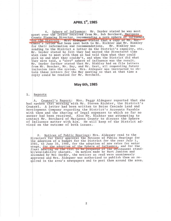
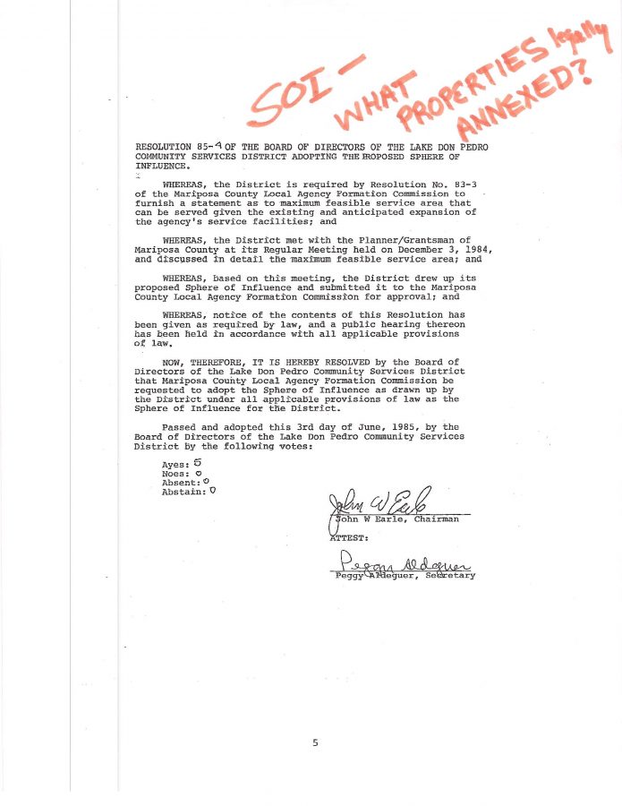
KAMPA stated the official LDPCSD SPHERE OF INFLUENCE (SOI) boundary was also established by LAFCo in 1987.

Something is not right here folks.

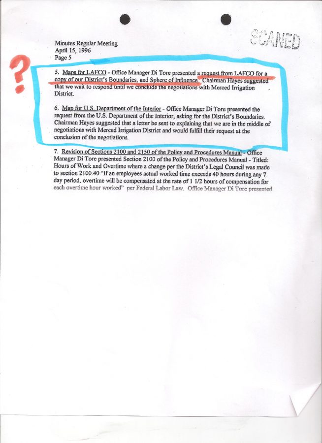
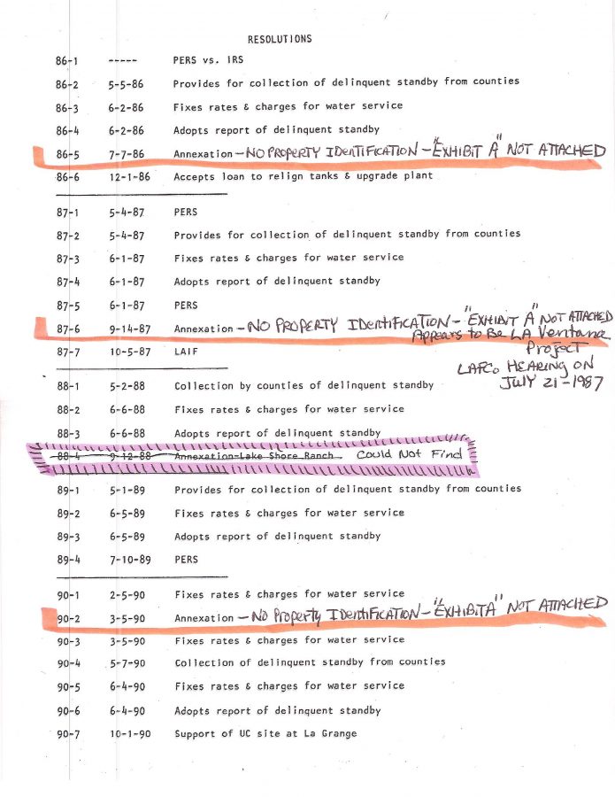
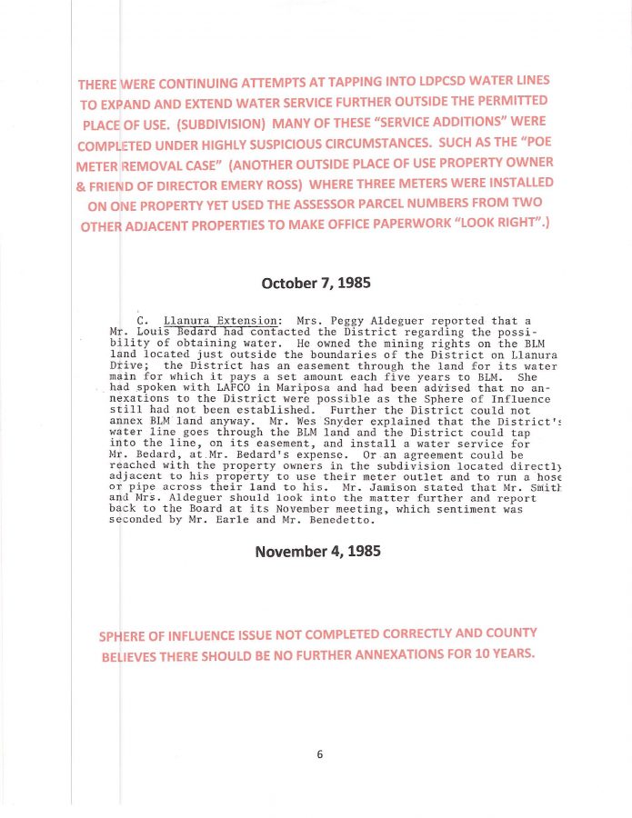
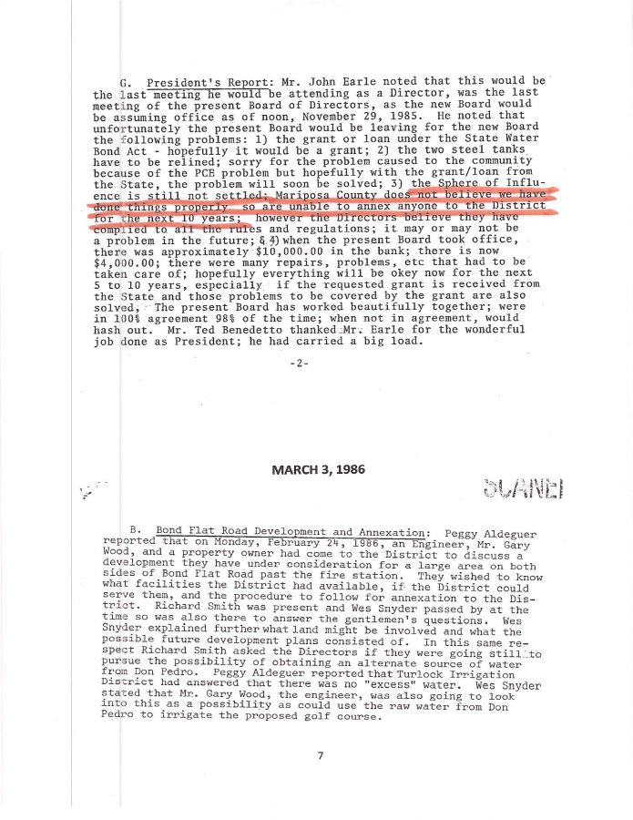
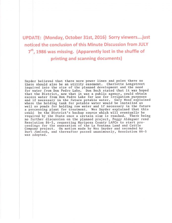
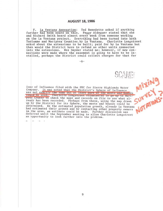
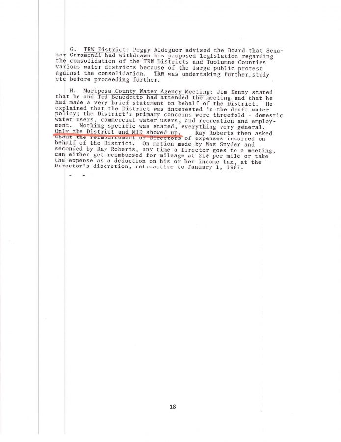
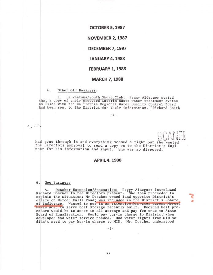
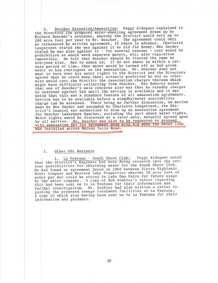
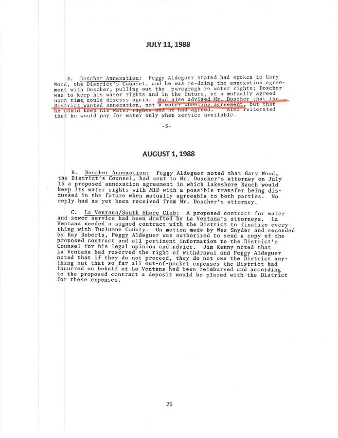
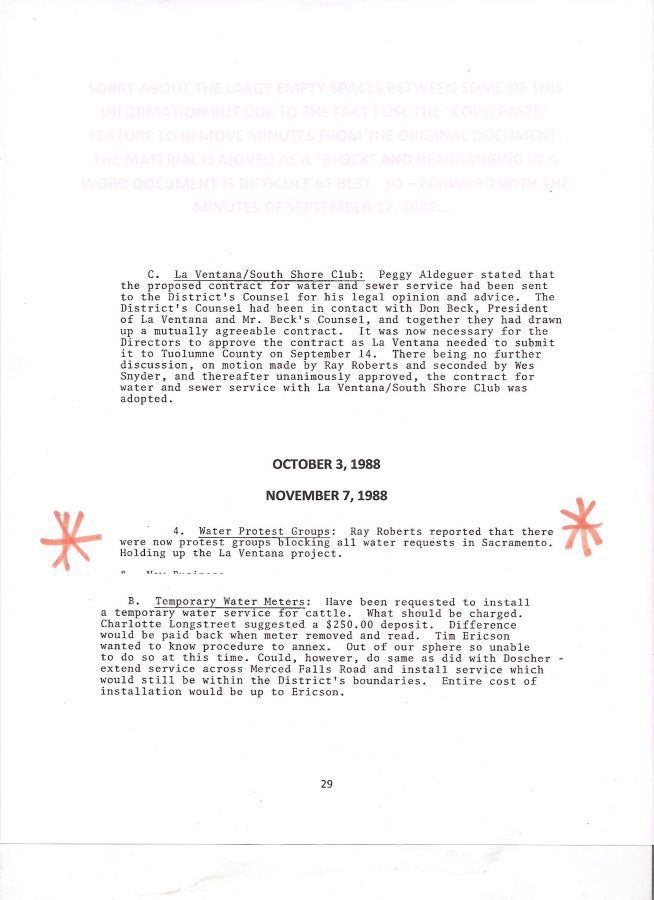
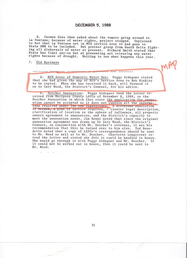
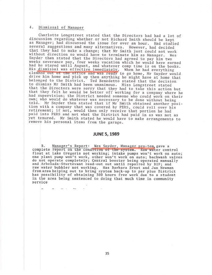
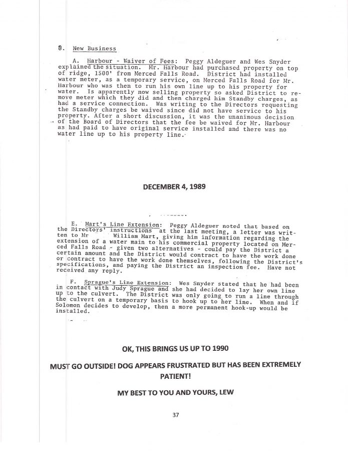
Check out page 5 (below) of the December 5th, 1988 LDPCSD Minutes

regarding this 900 +/- acre PROPOSED SUBDIVISION PROPERTY

which MARIPOSA COUNTY LAFCo in 2014 INCLUDED WITHIN THE LDPCSD SERVICE AREA!

NOTICE THE REFERENCE TO LAFCo CORRESPONDENCE

NOTICE THE REFERENCE TO LAFCo CORRESPONDENCE? Does LAFCo also destroy inconvenient historical records like the LDPCSD? 

Considering the above December 5th, 1988 LDPCSD BOARD MEETING MINUTES:


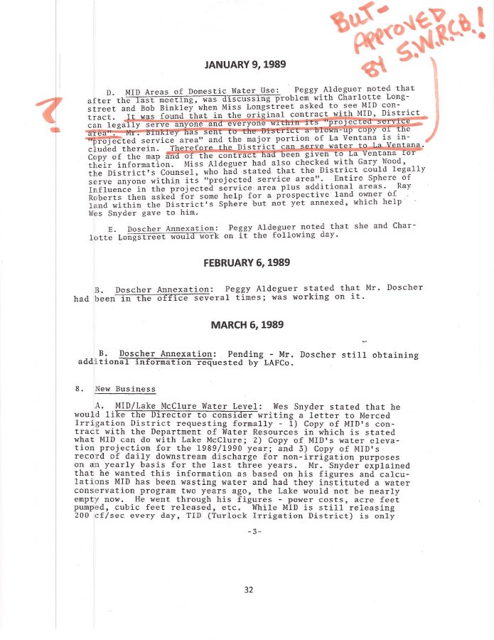
How could the DOSCHER PROPERTY even have been included in the LDPCSD Sphere of Influence in 1987 when major issues regarding property’s status existed in 1988?

How was the PROPERTY determined to be WITHIN THE LDPCSD SERVICE BOUNDARIES in 2014 by LAFCo and LDPCSD REPRESENTATIVES?

My best to you and yours, Lew

Categories: Uncategorized.

HEY, WAIT A BIT….WERE LAFCo COMMISSIONERS EVEN PRIVY TO THE EXPANDED BOUNDARIES ON THE MAP – OR JUST LAFCo STAFF?

IF YOU READ the recital carefully, there might be another way to interpret this…..yes indeed, it is a matter of parsing words, but lately that’s all we’ve heard from KAMPA & KOMPANY!


THIS WAS DONE WHILE I WAS STILL ON THE BOARD AND I REMEMBER BECAUSE I WAS TOLD I COULD NOT ATTEND THAT LAFCo CONFERENCE - DIRECTORY EMERY ROSS DID!


“THE MAPS WERE REVIEWED BY THE DISTRICT”  AND “THE MATTER WAS DISCUSSED WITH LAFCo STAFF” (Could be two different situations WITHOUT a meeting of the minds.  Discussion between LAFCo staff and district and they come out of “deliberations” with an agreement and ultimately receive Commissioner Approval without the Commissioners knowing all the facts of how SOI property suddenly jumped into the district service boundary without investigation?)

“THE DISTRICT HAS AGREED THAT THE SPHERE OF INFLUENCE AND SERVICE AREA BOUNDARIES DO REFLECT PAST LAFCo ACTIONS AND HAVE AGREED TO HAVE THEM INCLUDED IN THE LAFCo POLICY MANUAL”   Ahhhhh, what LAFCo actions?

WHAT INDIVIDUALS COMPRISED “THE DISTRICT”?

WHAT COUNTY PLANNING STAFF WERE INVOLVED?

WHAT LAFCo STAFF WERE INVOLVED?

WHEN WAS THE DOSCHER ANNEXATION APPROVED?

WHEN WAS AN MSR COMPLETED FOR THAT CSD BOUNDARY CHANGE?

WHY IS THIS THE FIRST MAP TO EVER SHOW THE DOSCHER PROPERTY AS WITHIN THE BOUNDARIES AND NOT SOI?

KAMPA STATED LAST WEEK THERE HAS NEVER BEEN AN ANNEXATION TO THIS DISTRICT SINCE 1980…. YET HE OBVIOUSLY AND SPECIFICALLY AVOIDED PRESENTING THIS “OFFICIAL LAFCo MAP” OF OUR BOUNDARIES EVER SINCE HIRED IN OCTOBER OF 2014, WHY?

BEFORE I LEFT THE BOARD (LATE 2014) THERE HAD ALREADY BEEN OBVIOUS TALK OF DISTRICT EXPANSION BEYOND THE PERMITTED AREAS OF THE WATER LICENSE, EVEN DANNY JOHNSON SPOKE OF HAVING FOUND SOMEONE WHO COULD WRITE THE GRANTS FOR THE MONEY FOR THE GROUNDWATER WELLS …..WAS THAT KAMPA A FEW MONTHS BEFORE HIS “BOARD ORCHESTRATED CLOSED RECRUITMENT PROCESS” APPOINTED HIM AND HIS KAMPA COMMUNITY SOLUTIONS, IGM?

WHY WAS I SPECIFICALLY PROHIBITED FROM ATTENDING THAT MEETING CONSIDERING I HAD DONE MORE RESEARCH ON THAT ISSUE THAN ANY DIRECTOR ON THE BOARD?  HELL MY GARAGE WAS A MAP LIBRARY!

DIRECTOR EMERY ROSS?  HOW COULD AN OUTSIDE PLACE OF USE PROPERTY OWNER, PREVIOUSLY DENIED WATER SERVICE BY BOTH THE SELLER OF THE LAND HE PURCHASED, AS WELL AS THE LDPCSD, START A COMMERCIAL CATTLE RANCH WITH A “LIBERATED WATER METER” FROM ANOTHER RANCHER, DEVELOP A STOCK WATERING POND IN THE MIDDLE OF SUMMER NEAR AN UNDOCUMENTED WATERLINE WHICH HAPPENS TO RUN THROUGH HIS PROPERTY WITHOUT A PUBLIC UTILITY EASEMENT OR CHECK METER;  WHO IS REPEATEDLY RE-ELECTED DUE TO THE GERRYMANDERING OF THE DISTRICT BOUNDARIES – BEEN ASKED BY THE GRAND JURY TO STEP DOWN AS PRESIDENT OF THE BOARD – POSSIBLY NOT HAVE A CONFLICT OF INTEREST WITH DETERMINING WHERE THE LEGAL LDPCSD WATER SERVICE BOUNDARIES WERE WHEN THE OFFICIAL RECORDS CONCERNING HIS OWN WATER SERVICE HISTORY WERE SOME HOW LOST THROUGH THE YEARS? 

STRANGE.  I RECALL AROUND THE TIME OF THE RAW WATER LINE BREAK AT BARRETTS COVE KAMPA SPECIFICALLY SAYING THERE HAD BEEN NO ACTION/WORK ON THE DOSCHER PROPOSED SUBDIVISION OR POSSIBILITY OF RUNNING A NEW RAW WATER LINE THROUGH HIS PROPERTY INVESTIGATED…….I ASKED DURING A MEETING – YET NOW THIS?


IF NOT FOR THE FACT I’M EXHAUSTED AND NEED SLEEP…..I MIGHT BELIEVE THIS WAS ALREADY A NIGHTMARE THAT JUST WON’T END

…..THAT’S IT, I’VE GOT TO CRASH.  GOOD NIGHT!  MORE LATER

MY BEST TO YOU AND YOURS, LEW


AFRAID TO SLEEP….MIGHT WAKE UP TO DISCOVER LDPCSD HAS ANNEXED DEATH VALLEY!


Categories: Uncategorized.

KAMPA & KOMPANY PRESENTS THEIR VERSION OF OFFICIAL LDPCSD BOUNDARY MAPS (get some popcorn – it’s a doozie!)

Wow, feel like I should be on SO WWW?

OK, much LDPCSD boundary expansion anticipated around the STURTEVANT RANCH/GRANITE SPRINGS AREA – if my green marks on the section map are any indication.  Why that far outside the MIDPOU for MERCED RIVER WATER service?  The STURTEVANT RANCH AGREEMENT makes sense with the respect to the 10 meters and future water use, although I believe it was limited as to a particular area, and I don’t have time to research that right now, but the point is of the agreement possibly influencing those boundaries makes sense on one level, but on another level it does not.

IF TEN METERS WERE PROVIDED FOR FUTURE WATER USE, THE NUMBER IS KNOWN, A PROBABLE USE DETERMINED.  10 SERVICE CONNECTIONS WHICH HELPS IN CALCULATING ANTICIPATED DEMAND FOR THE FUTURE (assuming traditional uses of water) but allowing anyone who subsequently purchases land from that ranch and is CLEARLY NOT ENTITLED TO A METER, IS REFUSED WATER FROM THE DISTRICT, BUT STILL SOMEHOW OBTAINS A WATER METER THAT IS CHARGED TO SOMEONE ELSE  (SOME RECORDS ARE MISSING/DESTROYED REGARDING THIS SERVICE) AND IS PERMITTED TO START A COMMERCIAL CATTLE RANCHING BUSINESS is a bit difficult to understand.   So anyway, there are very large parcels of land up there to the northeast and west of the residential subdivision that could multiply with future subdivisions bringing much higher water demands all based on, and INSURED BY, the property owners of the LDPOA and their GROUNDWATER SUBSTITUTION PROGRAM COMPLIMENTS OF KAMPA & KOMPANY.

ANYWAY, MAPS PRODUCED BY KAMPA 

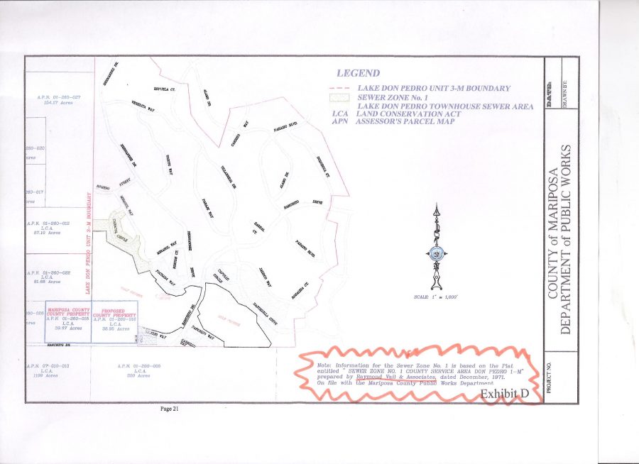
  1.  KAMPA’S “Exhibit B” LDPCSD OFFICIAL BOUNDARY MAP

The handwritten “15” was on the copy contained in the agenda packet.  I am unaware of the original material from which this map was removed but it sure looks to be a modified version of a 2008 LAFCo Map.   Since customers were once again required to hand number their own agenda packets, this map actually appeared on page 52 of the September agenda packet.

KAMPA & KOMPANY "EXHIBIT B" OF OFFICIAL LDPCSD SERVICE BOUNDARIES ON SEPT 19 2016

(ABOVE)  KAMPA “EXHIBIT B”   SERVICE BOUNDARIES ON      SEPT 19 2016


(BELOW)  2008 LAFCo MAP.  Modified copy of above?  Who knows which one was the first, but there are “unrelated blemishes” copied to both maps.  Also notice that although the LAFCo Map (bottom) is clearly labeled “Exhibit C” in the bottom right corner, it is also labeled in the title block to the left as “Exhibit B” in small print above the word LEGEND.   I  don’t know about you folks, but these maps sure as hell don’t look authentic to me – at least not produced by a professional engineer who surveyed the area.

LAFCo 2008 Draft Sewer MSR page 20 of 57

LAFCo 2008 Draft Sewer MSR page 20 of 57 “Exhibit C”

Now on the above LAFCo Map I must take responsibility for the yellow colored PINEY CREEK ISLAND OF SERVICE (something LAFCos are supposed to avoid – islands of services).  Years ago I marked that as a curiosity in my beginning journey in understanding our LDPCSD Boundary matters (wonder when that trip will end?).   Later I realized in addition to being an island of water service, it was also a good example of election Gerrymandering because that area does not receive LDPCSD water, pays no fees, but is supposedly in our district so individuals living in that mobile home park (and else where) can vote in our elections.

Considering our elections are sometimes settled by a very close margin (a few votes) this is a VERY BIG ISSUE THAT NEEDS INVESTIGATION AS WELL.  

How can individuals NOT VESTED IN THE DISTRICT possibly BE ALLOWED to determine who will or will not serve on the BOARD OF DIRECTORS?

Real sketchy information about that whole thing, but I do know such information is used in Sacramento by the State Board of Equalization (among other Boards, Departments, Agencies, Offices for various purposes) to establish the local TAX RATE AREA (TRA).  If it is still the same, LAKE DON PEDRO has many more TRAs than most, if not all, parts of Mariposa County.   There’s a blog posting on this site somewhere about that issue.  Anyway, I colored Piney Creek with a highlighter and ANY INVESTIGATION SHOULD TAKE A LOOK AT HOW TRAs figure into the fraud against the property owners of the LDPOA subdivision by the LDPCSD – for decades!2.


2.  KAMPA’S POSTED “SPHERE OF INFLUENCE” MAP ON THE LDPCSD WEBSITE

lafco-res-2014-15-page-4-soi-map-copy

Not a bad looking map and in all likelihood obtained from MARIPOSA COUNTY LAFCo RESOLUTION 2014-16 which updated LDPCSD Maps for their records.


(BELOW)  Here’s what the LAFCo LDPCSD SOI (Sphere of Influence) MAP looked like attached to LAFCo RESOLUTION 2014-15:

LAFCo page 4 LDPCSD SOI Map

LAFCo page 4 LDPCSD SOI Map


OK, the two maps appear to be the same, but wait a minute, something’s wrong here.  Check out where this SOI Map KAMPA used for the website came from – the LAFCo Resolution which contained two maps – not just the SOI!  This is where I get very upset and wonder how far LDPCSD corruption actually extends.


THIS WAS DONE WHILE I WAS STILL ON THE BOARD AND I REMEMBER BECAUSE I WAS TOLD I COULD NOT ATTEND THAT LAFCo CONFERENCE - DIRECTORY EMERY ROSS DID!

THIS WAS DONE WHILE I WAS STILL ON THE BOARD AND I REMEMBER BECAUSE I WAS TOLD BY THE PRESIDENT OF THE BOARD AND GM THAT I COULD NOT ATTEND BECAUSE DIRECTOR EMERY ROSS WAS GOING!  HELL, I EVEN HAD A RIDE WITH ONE OF THE COMMISSIONERS AT THE TIME!

lafco-res-2014-15-page-2lafco-res-2014-15-page-3-exhibit-a


lafco-res-2014-15-page-4-soi-map-copylafco-res-2014-15-page-5-ldpcsd-boundary-map-copy


DO YOU SEE IT?   THE DIFFERENCE OF PROPERTY WITHIN THE BOUNDARY? 

BOTTOM RIGHT QUADRANT? 

NOW I FINALLY UNDERSTAND WHY KAMPA HAS BEEN AVOIDING

THE MAP ISSUE FOR SO LONG!

WHY HE OFFERED THE “EXHIBIT B” MAP BELOW

AS THE OFFICIAL LDPCSD SERVICE BOUNDARY!

KAMPA & KOMPANY "EXHIBIT B" OF OFFICIAL LDPCSD SERVICE BOUNDARIES ON SEPT 19 2016

KAMPA & KOMPANY “EXHIBIT B” OF OFFICIAL LDPCSD SERVICE BOUNDARIES ON SEPT 19 2016

INSTEAD OF THE OTHER LAFCo MAP BELOW!


lafco-res-2014-15-page-5-ldpcsd-boundary-map


NOW IT GETS INTERESTING

Check out the above documents.  I am mad as hell because the way I see it there are few ways for something like this to occur.  Unfortunately the most probable orbit around REPRESENTATIVES OF THE LDPCSD INTENTIONALLY PROVIDING FALSE INFORMATION TO MARIPOSA COUNTY PLANNING AND LAFCo WHO THEN WITH A “WINK AND A NOD” ACQUIESCED BY ACCEPTING AND PLACING THIS ABSOLUTE FABRICATION OF THE TRUTH IN OFFICIAL LAFCo FILES.  (SURE HOPE THE COUNTY TAKES BETTER CARE OF OFFICIAL RECORDS THAN THE LDPCSD.)

AT THIS POINT I REALLY DO NOT KNOW WHO TO TRUST,

SO AS ALWAYS, I LEFT THAT ISSUE WITH YOU – THE PUBLIC VIEWERS. 

I BELIEVE THERE IS SOMETHING HORRIBLY WRONG HERE THAT TRANSCENDS JUST A DEVIOUSLY CREATED AND CORRUPTED COMMUNITY SERVICES DISTRICT.   IT IS THE WHOLE  “DO WHAT EVER IS NECESSARY ENVIRONMENT” THAT IS CONSUMING OUR ENTIRE COUNTRY.   “YEAH, THAT’S REAL BAD BUT……”   “NOT MY JOB”  “I DON’T CARE WHAT THEY DO”  “SO LONG AS I DRAW A PAYCHECK/STIPEND”  “WHY SHOULD I RISK MY FAMILY’S SECURITY TO LOCK HORNS WITH THE MOVERS AND SHAKERS OF THIS AREA?”  “WHO WILL EVER FIND OUT?”  “WHAT’S THE WORST THEY COULD DO?”  “JUST SAY IT WAS A SIMPLE MISTAKE”……oh what a tangled web we weave

SO MANY GOOD HONEST PUBLIC OFFICIALS GET TAINTED WITH, CAUGHT UP, OR PULLED INTO, SUCH OBVIOUS CIRCUMVENTION OF, NOT ONLY ESTABLISHED RULES AND REGULATIONS THAT MAY BE INCONVENIENT AND OBSTRUCT DESIRED PROGRESS, BUT THE METICULOUS AVOIDANCE OF SOMETHING FAR MORE IMPORTANT – THE TRUTH!

EVERYONE IS HARMED, INDIVIDUALS, COMPANIES, COMMUNITIES, AND EVERY GOVERNMENT AGENCY AND/OR EMPLOYEE INVOLVED IN SUCH APPARENT FRAUD WHO TURNS THEIR HEAD AND IGNORES WHAT THEY KNOW TO BE WRONG – MINIMIZES THEIR OWN REPUTATION AS WELL,  BE IT PROFESSIONAL, INDIVIDUAL, SPIRITUAL, WHATEVER – WHERE IS THE BASIC CONCEPT OF CONSCIENCE AND SHAME?

There’s a lot more to this but I’m pooped.

My best to you and yours, Lew


——and may those involved with this continuing fraud against their neighbors ultimately receive exactly what they have earned.


Categories: Uncategorized.

WHY NOT A HUNDRED, SEVERAL HUNDRED, MAYBE A THOUSAND NEW DEVELOPMENTS ON GROUNDWATER SUBSTITUTION PAID FOR BY THE OWNERS IN THE LDP SUBDIVISION?

WHY NOT A HUNDRED, SEVERAL HUNDRED OR A THOUSAND NEW SERVICES DEPENDENT UPON GROUNDWATER SUBSTITUTION PAID FOR BY THOSE WHO HAVE A RIGHT TO MERCED RIVER WATER?

Is a wrong any less wrong when simply distributed among more victims?   Humm, let’s mull that over.

NO DOUBT TOUGH, BUT THAT IS NOT THE ISSUE

Developing your own groundwater well in a drought prone area like Lake Don Pedro can be a risky and expensive proposition in this geologic fractured rock and historically drought prone area.   Not like the valley where there are (were?) vast underground aquifers where users could drill wells as easy as punching a stick straw in a juice bag or carton when thirsty.  Yup, that’s all now changed and State regulations reflect the seriousness of water shortages, over drafting, land subsidence, lack of conservation, etc.

Still, quite unfortunate that it can cost a property owner a great deal to obtain sufficient quality water for development, but that’s another variable, what sort of land development requires the water?  A single family residential structure with typical associated outbuildings would require far less potable water than a several hundred parcel subdivision.  You don’t need to be an engineer to comprehend that little piece of reality.

MOST EVERYONE UP HERE SACRIFICED SOMETHING

Generally, we all must sacrifice something in order to reside (or hope to reside) in this beautiful, but often harsh, western Sierra Nevada foothill area.  Obviously traditional shopping is made a bit more inconvenient and the variety of products and services is limited, little things like that, however, there is another way many residents were able to develop up here which was “PAID FOR” in a different MORE SUBTLE, but very effective way.

STOP!  YOU CAN’T DO THAT ON YOUR PROPERTY!      

Property owners in the LDPOA residential subdivision sacrificed what many might consider “FREEDOM” in order to purchase and develop their property due to Community Interest Development CC&Rs (Covenants, Codes, and Restrictions) and the  DAVIS STIRLING COMMON INTEREST DEVELOPMENT ACT  contained in the California Civil Code starting with section 4000).   Without delving too deep into the pros and cons of CIDs, CC&Rs, Davis Stirling, and that whole concept of another layer of government to contend with,  etc. suffice it to say they are TYPICALLY FAR MORE RESTRICTIVE THAN COUNTY REGULATIONS WHEN IT COMES TO DEVELOPING YOUR PROPERTY.

One of the standard restrictions is that no property within the residential unit can again be subdivided – such as an owner dividing his 1 acre lot into two ½ acre parcels or four 1/4 acre lots.  Rules prohibit certain “cottage industries”, size and placement of the residence, even the species and number of animals permitted, some developments even regulate building colors, themes, and how much work an owner can perform on common areas.  It all depends upon your community development CC&Rs and the enforcement policies of your association.

Here in Lake Don Pedro “most” property owners cannot develop their own groundwater wells and MUST BE CUSTOMERS OF THE LDPCSD.  NO CHOICE.  Want water?  Then it must be provided by the LDPCSD according to their rules and regulations.   Yup, not like propane service where if you are dissatisfied with the price or service you can purchase elsewhere.

Weird huh?  LDP subdivision property owners MUST OBEY CSD rules and regulations to obtain water yet the CSD violates their own operating regulations while obtaining the water they serve anywhere they want!

KAMPA & KOMPANY REFUSE TO PRODUCE MAPS

(Please recall “KAMPA & KOMPANY” is a shorthand reference to PETE KAMPA and all those who support the effort to transform our surface water treatment plant into a Groundwater Substitution facility – whose “alternate source of water” was specifically developed with public funds – in order to provide special benefit water services to third party land developers whose properties LIE outside the permitted place of use for MERCED RIVER WATER under license 11395 held by the MERCED IRRIGATION DISTRICT –  under which the LDPCSD has pumped water from Lake McClure since its formation in 1980 – while the 99% of legally entitled MERCED RIVER WATER users in the LDP subdivision have been forced to pay for this deception with rates and fees they have contributed to the LDPCSD since 1980 while those who require this GROUNDWATER SUBSTITUTION have not paid their FAIR SHARE OF AVAILIBILITY  <gasp>    lol)

ANYWAY….KAMPA & KOMPANY have for several months intentionally and repeatedly ignored and avoided TWO PRIMARY OPERATIONAL REGULATIONS OF THE LDPCSD which can be clearly illustrated on legitimate official maps:

THE MERCED IRRIGATION DISTRICT PLACE OF USE MAP (MIDPOU)     (GREEN LIKE $$$)

Based on MERCED RIVER WATER restrictions in License 11395 which MID holds. Strange how a GROUNDWATER SUBSTITUTION PROGRAM (to replace Merced River Water that wrongfully leaves the MIDPOU) can legally change not only WHERE the water can be used, but HOW it is used also.  Apparently L11395 does not entertain/permit COMMERCIAL CATTLE RANCHING with treated water clearly intended for domestic consumption in the LDP subdivision, yet GROUNDWATER REPLACEMENT can be used for anything, including resale under different circumstances than what L11395 permits.

THE LAFCo WATER SERVICE BOUNDARIES MAP      (GREEN LIKE $$$)

Kampa has repeatedly stated the LDPCSD Service Boundaries were created by LAFCo when LDPCSD was established in 1980 and have not changed since.

Really?

Surely as PRESIDENT & CEO OF KAMPA COMMUNITY SOLUTIONS llc (A HIGHLY PAID PROFESSIONAL MANAGEMENT COMPANY FOR SPECIAL DISTRICTS AND AGENCIES) and being an instructor to water agency employees, IGMs, GMs, and politicians within the STATE WATER INDUSTRY – AND HAVING A FEW YEARS PRIOR EXPERIENCE WITH OUR LDPCSD –  GOOD ‘OL PETE WOULD HAVE THE UP TO DATE INFORMATION. 

RIGHT?

WRONG!

Why would PETE KAMPA use that old “EXHIBIT B” map which illustrates both SOI and Service Boundaries on the same map to support his presentation?  (Which, incidentally, was incorrect anyway because the 2,010 acres of the approved South Shore Project were not included as IN THE DISTRICT BOUNDARIES!)

This is not a matter of ACCIDENTALLY using an antiquated map, but rather, ONCE AGAIN KAMPA & KOMPANY HAVE GONE TO CONSIDERABLE EFFORT TO INTENTIONALLY CONCEAL AND OBSTRUCT WHAT THE “LDPCSD BOUNDARY EXPANSIONISTS” HAVE BEEN DOING BEHIND THE SCENES SINCE EVEN BEFORE THIS DISTRICT WAS FORMED IN 1980 BY COUNTY LAFCos ——

AND THAT IS,.,.,

CONTINUING THE EFFORTS TO FURTHER EXPAND DISTRICT BOUNDARIES WITH PROPERTIES OUTSIDE THE MERCED IRRIGATION DISTRICT PLACE OF USE  FOR MERCED RIVER WATER WHICH PLACES A FURTHER FINANCIAL BURDEN ON THE ENTITLED USERS OF MERCED RIVER WATER IN THE LDP SUBDIVISION DUE TO THE NECESSARY GROUNDWATER SUBSTITUTION PROGRAM KAMPA & KOMPANY CREATED WITH PUBLIC FUNDS FOR A SPECIAL BENEFIT WATER SERVICE FOR THIRD PARTY LAND DEVELOPERS FOR WHICH OUR DISTRICT HAS NO LEGAL DUTY OR MORAL OBLIGATION TO SERVE WATER AT ALL!

KAMPA obviously had access to LAFCo’s 2014-15 UPDATED MAPS

because he used the

LAFCo RES 2014-15

SOI MAP ON THE WEBSITE! (WHICH ACCOMPANIED THE BOUNDARY MAP!)

WHAT A DECEITFUL PIECE OF…. krapa!

DIRECTOR ROSS’s CATTLE RANCH IS A PERFECT EXAMPLE OF FORESEEABLE CONSEQUENCES WHEN ALLOWING LARGE PARCELS INTO OFFICIAL BOUNDARIES THAT ARE NOT PERMITTED TO RECEIVE MERCED RIVER WATER UNDER L11395.

OK, it certainly appears as though the SUSPICIOUS SURVEY will end up producing a map with areas far outside the MIDPOU – well at least in one area around GRANITE SPRINGS WHERE ROSS DEVELOPED HIS COMMERCIAL CATTLE RANCH that was originally part of the STURTEVANT RANCH.

OK, we know that story based on “surviving documents of the LDPCSD AND THOSE PRODUCED BY THE STURTEVANT RANCH”.

In the late 1960s Boise Cascade engineers while constructing the [MERCED RIVER WATER ENTITLED] LDP residential subdivision in that area, realized they required another water tank and contracted a deal for a tank site and easement in exchange for some cash and 10 water meters to be used in the future.  (The individual brokering that water meter deal with STURTEVANT back in the 1960s was a shareholder in Sierra Highlands Water Company and a member of the BINKLEY FAMILY which to this day is the LDPCSD’s engineering firm.)

Did LAFCo extend the LDPCSD Water service boundary there so as to include the STURTEVANT RANCH PROPERTY because of the water tank location agreement?

OR Did they PERHAPS expand that service area for another reason AS WELL?

BUT IF because of the agreement, is there any mention of this in LAFCo documents during the LDPCSD Formation?

Why would the issue of HOW MERCED RIVER WATER WOULD BE SERVED TO THE ENTITLED SUBDIVISION, become an issue of WHERE ELSE MERCED RIVER WATER COULD BE SERVED WITHIN THE DISTRICT?

BACK TO FORESEEABLE CONSEQUENCES

So Emery Ross wants to purchase property from the STURTEVANT RANCH yet is SPECIFICALLY ADVISED he had NO RIGHT to a water meter.

ROSS purchases the property never-the-less and is subsequently denied water by the LDPCSD multiple times.

ROSS had connections within the LDPCSD and somehow obtains a STURTEVANT WATER METER; has a fictitious water service approval date placed in district records; starts a commercial cattle ranching business with treated water intended for domestic residential consumption in the subdivision across the street; and begins authoring a bi-weekly column in the only local newspaper owned by a friend.  His column was called Ranching Don Pedro.

Nine years later a Sturtevant Ranch member attending an LDPCSD Board meeting sees some paperwork with Emery’s name on it identified as having a STURTEVANT WATER METER and discovers the MISAPPROPRIATION OF SEVERAL WATER METERS BELONGING TO THE STURTEVANT RANCH.

Naturally the Sturtevant Ranch demands correction.

Big surprise, LDPCSD records could not initially be found, but the issue was eventually resolved with the STURTEVANT RANCH meters replaced in their account.

Ross and the several other OUTSIDE MIDPOU property owners were allowed to keep their wrongfully acquired water service and the pre-dated service dates indicating they were approved under BOISE CASCADE.

Think of the AVAILABILITY FEES THAT WERE NEVER PAID IN RESTITUTION TO THE DISTRICT FOR THESE “LATE ON THE SCENE PROPERTIES” NOW RECEIVING WATER.

LDPCSD AVAILABILITY FEES:  (BASED ON LDPOA SUBDIVISION LOTS WITH AN AVERAGE SIZE OF 2 ACRES  +/- .   $60 an acre, maximum 3 acres for $180/year.   So applying the same formula for much larger parcels OUTSIDE THE MERCED RIVER WATER ENTITLED SUBDIVISION, dividing by the maximum of 3 acres (@ $180) would be reasonable.

SO:

EXAMPLES:  100 ACRES/3 ACRES = 33.33 ACRES x $180 = $5,999.40 A YEAR [1993-1980 = 13 YEARS X $5,999.40 = $77,992.20 IN AVAILABILITY FEES THAT WERE NOT PAID. (GEE, ALL LDPOA PROPERTY OWNERS THAT ARE MANDATORY CUSTOMERS OF THE LDPCSD HAVE PAID $60/AC  UP TO $180/3 AC SINCE THE DISTRICT STARTED CHARGING FEES!)

900 ACRES/3 = 300 ACRES X $180 = $54,000/YEAR   [1993-1980 = 13 YEARS X $54,000 = $702,000]

IF THE ABOVE SUCH EXAMPLES HAD PAID THAT KIND OF MONEY THROUGH THE YEARS TO “BUY IN” IT WOULD MAKE A BETTER CASE FOR INCLUSION INTO THE DISTRICT, BUT THEY DID NOT.  BESIDES, REGARDLESS OF THE LOST REVENUE IN PROPERTY TAX AVAILABILITY WE WERE STILL PILING ON MORE LIABILITY FOR A GROUNDWATER SUBSTITUTION PROGRAM.  FURTHER SERVICE OUTSIDE THE MIDPOU BOUNDARY DOES NOT MAKE MUCH SENSE – UNLESS YOU ARE THE ONE RECEIVING THAT SPECIAL INTEREST BENEFIT..

CONSIDER THIS:   SINCE KAMPA CONTENDS THE ROSS RANCH (and other large holding of land) ARE WITHIN DISTRICT BOUNDARIES (not MIDPOU for MERCED RIVER WATER SERVICE REMEMBER)………….

theoretically such properties with a co-operative EXPANSIONIST MOTIVATED MANAGEMENT TEAM like KAMPA & KOMPANY could easily develop into a hundred, several hundred or thousands of new home sites (OR CATTLE RANCHES, CAR/TRUCK WASHES, WATER PARKS, ETC.!

ALL OUTSIDE THE PLACE OF USE FOR MERCED RIVER WATER!

NOW HERE IS THE KICKER…..

Thousands of homes buil (OR WHATEVER)  OUTSIDE THE PLACE OF USE FOR MERCED RIVER WATER, whose extremely expensive GROUNDWATER SUBSTITUTION PROGRAM would be FINANCIALLY SUPPORTED by the property owners of the LAKE DON PEDRO OWNERS ASSOCIATION subdivision WHO HAPPEN TO BE THE ONLY LEGALLY ENTITLED MERCED RIVER WATER USERS IN THE DISTRICT!
NOT ONLY THAT…..those properties are also essentially insured against failure because if the ground well fails – it’s already been deeded to the LDPCSD SO WE HAVE TO REPLACE THAT EXPENSIVE PIECE OF SPECIAL BENEFIT!

WHAT A FRACKEN SCAM THAT WAS/IS APPARENTLY

SUPPORTED BY MARIPOSA COUNTY PLANNING AND LAFCo !!!

I need to get to “other work”.

My best to you and yours, Lew

Oh yeah:

Is a wrong any less wrong when simply distributed among more victims?

Recall this when your LDPCSD water bill is doubled or tripled in order to

pay for all these special benefits for properties NOT ENTITLED TO MERCED RIVER WATER!

TRULY DISGUSTING.

OH YEAH…..,.

VOTE NO ON ANY SUBSEQUENT

LDPCSD PROP 218 THAT SUPPORTS THIS

KAMPA KRAPA FRAUD!


Categories: Uncategorized.

THE 1980 LAFCo SURVEY FOR THE FORMATION OF “LDPCSD SERVICE BOUNDARIES” IS CRITICAL INFORMATION

WHY IS AN INVESTIGATION NECESSARY?

Past LDPCSD actions have been based on documents and maps to support those actions.  Yet those very records used in support of OFFICIAL ACTIVITY have been subject to selective interpretation, application, and enforcement.  Those documents and maps have been subject to unlawful modification, fabrication, theft, burglary, even arson (admin office destroyed in Feb 2012), come to think of it, wasn’t there also a new records retention and destruction policy Kampa got the board to approve?  What miserable tiny little scrap of truth and fact remains is circumvented with other fabricated garbage all utilized as evidence in support of management’s reconfiguration and future direction of this district to third party special benefit.  Which coincidentally, is in obvious conflict with original founding documents and the intended purpose of the district.    Oooops!

Here’s the hook…..the legally entitled customers (99%) pay for it.  They started paying back then.  They pay now.  And KAMPA & KOMPANY is trying to set it up so we pay FOREVER!

They sure are lucky all those records disappeared.    Or did they?

Official county records have also been corrupted with bad information apparently originating from whatever management LDPCSD was going through at the time.  A real roller coaster through the decades.   But here’s the kicker, if the county was deliberately deceived about the facts with all the turmoil, arguing, court hearings, threatened lawsuits and crap for years…..why do they allow it to happened again, and again, and again?  Didn’t someone, somewhere in Mariposa County government recognize an obvious pattern of deception by that public service agency?  Or was the County itself going through their own “cycle” of who is best to – and knows how to – run this county political garbage?   I don’t know, but way beyond my research capabilities.  I’m just trying to understand how an exception to the rule in water service has mutated into re configuring our SURFACE WATER TREATMENT PLANT INTO A GROUNDWATER SUBSTITUTION PROGRAM GEARED TO THE SPECIAL INTEREST AND BENEFIT OF THIRD PARTY LAND DEVELOPERS.

Was Mariposa complicit with this plan to subsidize land development with “trapped property owners in the Lake Don Pedro Owners Association residential subdivision”?(and to a much lesser extent Tuolumne County – because at least they drew the line with a “late comer” land development company out of the Bay Area in early 2000 – see?  I’m learning)

Where were/are the government oversight “watchdogs” to ensure that the County itself or its citizens weren’t/aren’t getting ripped off somehow?  Or exposed to serious liability for knowingly permitting this misrepresentation to continue?  (Same as SRA Fire Safe Roadway Regulations being  completely ignored by the “late comer developer” – but no action by county to stop or correct?)

Seems to me a methodical inspection as to what LEGITIMATE EVIDENCE REMAINS would be a good starting point.  (That is why I am so disgusted that after months of waiting for KAMPA & KOMPANY assurances of action nothing materialized but the KAMPA KRAPA presentation at the September 19th, 2016 monthly Board of Directors meeting.  OK.  Let’s work with that.

A SERIOUS LEGITIMATE INVESTIGATION IS NECESSARY TO PROTECT LDPOA PROPERTY OWNERS (aka MANDATORY CUSTOMERS OF THE LDPCSD!)

The LAKE DON PEDRO COMMUNITY SERVICES DISTRICT [LDPCSD] is a public agency and subject to the laws of this country, local, State, and Federal.  Starting with known regulations and restrictions seems logical.

MULTIPLE AUTHORITIES and JURISDICTIONS

The Counties of Tuolumne and Mariposa regulate and control areas within their respective county jurisdictions.  The STATE WATER RESOURCES CONTROL BOARD established how and where that MERCED RIVER WATER could legally be used under water license 11395 held by the MERCED IRRIGATION DISTRICT.  Federal government agencies also regulate water issues within this state.  Federal regulations also specifically determined how and for what projects public grant funding would be available for public water distribution agencies such as the LDPCSD.  Grant funds are not FREE MONEY without  “strings attached” (As Wes Barton most recently pointed out at an LDPCSD board meeting).  The management company for a designated public agency, that also happens to be a designated disadvantaged community,  can not use those funds TO PROVIDE SPECIAL NEW WATER SERVICES OUTSIDE THE MIDPOU.

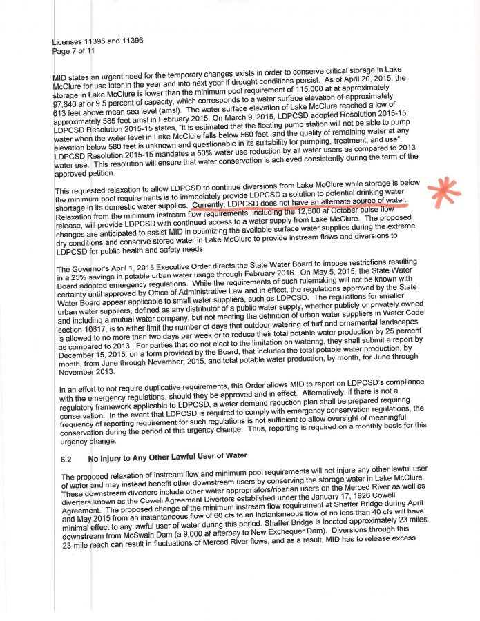
BUT WHAT IF MERCED RIVER WATER IS USED OUTSIDE THE LEGAL AREA?

Water service with MERCED RIVER WATER outside the legal PLACE OF USE is a violation of the license restrictions yet violations can be remedied through a process called GROUNDWATER SUBSTITUTION FOR SURFACE WATER TRANSFER.   (A legal way to actually intentionally circumvent the restrictions in the license.)

MERCED RIVER WATER, which flows from Yosemite National Park and is held or “impounded” in LAKE McClure, is considered “SURFACE WATER” and this is where the LDPCSD has always pumped water for delivery to customers.  Every unit of MERCED RIVER WATER (from :McClure) that is delivered “OUTSIDE THE POU” (Place of Use) must be replaced with an equal or greater amount of an “ALTERNATE SOURCE OF WATER” – which is any other water available that is not MERCED RIVER WATER!  (lol).  For the Lake Don Pedro area this means the use of expensive, and often times unreliable production, of a frequently lower quality groundwater.  MERCED RIVER WATER IS SOME OF THE BEST WATER IN THE STATE!

SO, RECAP, every gallon of MERCED RIVER WATER that is delivered OUTSIDE THE LICENSE Place of Use (POU) must be replaced with a gallon of GROUNDWATER. 

The LAKE DON PEDRO SURFACE WATER TREATMENT PLANT was specifically created for the LAKE DON PEDRO residential subdivision and operated under MERCED IRRIGATION DISTRICT WATER LICENSE 11395……so-

it should be of

no big surprise

that the

MERCED RIVER WATER PLACE OF USE fits the subdivision boundary like a glove!

Compare the two maps, notice that every time the water license boundary juts in a particular direction that is exactly where you will find a residential neighborhood of the LDP subdivision.  Already approved with infrastructure (delivery system pipes, etc) installed.   The LDP subdivision is a SHADOW OF THE MID POU.

MAKES SENSE THAT INFRASTRUCTURE WAS INSTALLED, BUT…..

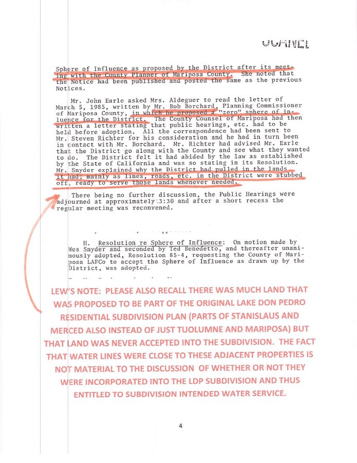
Subdivision infrastructure was installed to deliver MERCED RIVER WATER to each entitled parcel in the subdivision and a few exceptions outside the residential development.  But here’s the kicker,  the subdivision was originally going to include the two other counties – Stanislaus and Merced, but those plans were abandoned (was this because they were proposing to expand into areas beyond the available water under 11395?  Why Boise constructed then abandoned over 12 groundwater wells in an attempt to expand that service yet still could not without sufficient good groundwater?)  Making matters worse, some adjacent properties (abandoned from LDPOA inclusion) did have water lines close but could not legally receive the MERCED RIVER WATER pumped from McClure. [Hey, they didn’t want all the subdivision rules, CC&Rs, Board of Directors, annual assessments, blah blah blah…..they wanted out!  They got out.  But then later they demanded the one BIG SELLING POINT FOR LAKE DON PEDRO PROPERTY ……our water.  Go figure.

 UNFAIR

The 99% of legally entitled MERCED RIVER WATER USING customers of the subdivision (3,000 +/-) who because of that property ownership are mandatory customers of the LDPCSD, have been FORCED TO SUBSIDIZE A SPECIAL BENEFIT WATER SERVICE FOR PRIVATE LAND DEVELOPER PROJECTS OUTSIDE THE LEGAL PLACE OF USE FOR DECADES.  THIS NEEDS TO STOP IMMEDIATELY BECAUSE IT WILL INCREASINGLY GET MORE EXPENSIVE.

SOME INITIAL OBVIOUS QUESTIONS:

WHY DID LAFCo (when forming the new LDPCSD) expand those water service boundaries far beyond that of water license 11395?

WHY DID LAFCo expand the LDPCSD boundaries beyond what the  CALIFORNIA PUBLIC UTILITIES COMMISSION approved in the transfer of facilities and assets for that proposed new community services district?

What evidence is there that LAFCo expanded the service boundaries beyond the water license as well as the CPUC transfer approved service boundary?

EVERYONE SAYS THIS IS IT!  THE OFFICIAL DOCUMENT DESCRIBING THE LDPCSD WATER SERVICE BOUNDARIES!  
(really?  Fool me once, shame on you, fool me twice shame on me, fool me multiple times year after year after year…..?

you must be from the government!

  lol)


THE INFAMOUS SURVEY

Personally I have a hard time accepting anything as “official” if the document does not contain common sense information one would expect to observe on something used as “evidence” of a particular transaction, process, or project.  Even as children we were taught in school to put our name, date, and subject on all homework.  High school drafting classes emphasized how the title block of a drawing should always contain project title, date, drafter’s name, revision number, relevant notes, etc..  (Maybe it did?  But the original map can’t be found)

This survey seems very suspicious to me considering the importance of the document and how it appears to be in DIRECT CONFLICT with other known and accepted documents such as the water restrictions and the Public Utility Commission’s approval of the service area for the new district.

Basic questions.

A surveyor can only survey what was requested to be surveyed, right?.  Someone instructed this individual to use the metes and bounds engineer descriptions for the legal purpose of describing a particular geographical area and establishing a water district.

I doubt the surveyor walked over a hill and said “Oh there’s a nice looking little valley with a seasonal creek, I think I will include it in this new district that the Mariposa County LAFCo is forming”.

WHEN was this survey performed?

WHO paid for the survey?

WHO instructed the surveyor WHAT to survey?

Did LAFCo cause that survey to be made or was it presented as founding information by district supporters?

WHY do service boundaries go beyond what had already been approved by CPUC?

WHY do service boundaries go beyond the license restrictions?

WHERE IS THE ORIGINAL MAP BASED ON THIS SURVEY?

IS THIS EVEN THE ORIGINAL SURVEY OR MERELY ONE SUBSTITUTED FOR THE ORIGINAL?

WHY NOT PROPERLY IDENTIFIED?

(I’m exhausted.  I would bet money, marbles or chalk that many of you viewers have thought of better questions.  Sorry. I’m beat.)

HERE IS THE INFAMOUS SURVEY

(WITHOUT THE ORIGINAL CORRESPONDING “OFFICIAL SERVICE BOUNDARY MAP” -of course.)

boundary-exhibit-a-p1boundary-exhibit-a-p2exhibit-a-p4exhibit-a-p5exhibit-a-p6exhibit-a-p7exhibit-a-p8exhibit-a-p9exhibit-a-p10exhibit-a-p11exhibit-a-p3

Without the corresponding map, the “metes and bounds” description is not very helpful in locating a particular piece of property to see if it is in the LDPCSD water service boundaries or within the MERCED IRRIGATION DISTRICT PLACE OF USE FOR MERCED RIVER WATER UNDER L11395 – is it?

???????????????????????

While waiting for KAMPA & KOMPANY to burn through thousands of more LDPCSD dollars to re-create a map that should never have been stolen, destroyed, or purposefully concealed in the first place, I decided to attempt gleaning some usable information from all those degrees, numbers, distances, and headings contained in the survey KAMPA & KOMPANY maintains are the LDPCSD’s OFFICIAL SERVICE BOUNDARIES.

BACKGROUND.  When I first purchased my LAKE DON PEDRO property in 1990 I wanted to learn as much about this area as I possibly could so I ordered a complete set of available maps for this area.  Fascinating information which included identifying Federal and State lands, maps illustrating topographic, geologic, and water features, roads highways, a map of earthquake history (hard to believe how many are confirmed in this area), land uses, agricultural, mining, environment preserves, etc. A bunch of cool maps!  About a hundred dollars worth!

For this little experiment I used a BLM map with defined Township, Range and Section grids.

20161001_02_01

BLM MAP20161001_06_01

  Although I am certainly not an engineer or surveyor, I was able to understand a couple of coordinate descriptions on PAGE TWO OF THE SURVEY.  [INSIDE GREEN BOX]

Page 2 of survey

Page 2 of survey

I then sparingly marked these descriptions on the map with a green marker (don’t want to ruin my beautiful map!  lol)

20160929_80

(Above:  Sections 34, 35, 2 and 3 marked)

Certainly this survey will indicate property OUTSIDE THE MERCED IRRIGATION DISTRICT PLACE OF USE FOR MERCED RIVER WATER around the Granite Springs area.

Below is a Mariposa County Map I obtained illustrating the same area with the only notation I could find designating the LDPCSD boundary.  None of the properties around the border of the subdivision had this notation.

COUNTY MAP WITH LDPCSD BOUNDARY NOTATION (ONLY ONE FOUND)

Below is a map identifying locations of LDPCSD water tanks.  The Sturtevant tank is the upper far right blue push pin.  Notice all the subdivision roads, streets, drives, cul de sacs, etc…..gee, a clue to who was supposed to receive the water?

 20161001_09

The Sturtevant tank issue was not a matter of WHERE MERCED RIVER WATER COULD OR WOULD BE SERVED, but rather HOW IT WOULD BE SERVED TO THE ALREADY DESIGNATED LAKE DON PEDRO RESIDENTIAL SUBDIVISION.  Just look at the maps.  Again, the MID POU fits around the subdivision like a glove.   Why did LAFCo (if they indeed had this “peculiar survey” conducted) expand the LDPCSD service boundaries so far?  Why wasn’t this Sturtevant property designated SOI (Sphere of Influence) rather than inside the boundary?


I need a break


My best to you and yours, Lew


Just thought of another good blog posting title:     “GIVE THEM AN INCH AND THEY WILL STEAL YOUR SURFACE WATER TREATMENT PLANT!”  

not so lol huh?

so much more…….,.


Categories: Uncategorized.

5 “F”s OF A KAMPA & KOMPANY PROP 218 RATE/FEE INCREASE?

VERY DISAPPOINTING.  VERY DISHONEST.  SO FRACKING  FRUSTRATING!

LDPCSD CUSTOMERS – DO NOT EVER FORGET THIS CONTINUING MISREPRESENTATION, CONCEALMENT OF RELEVANT FACT, AND THE CALCULATED DUPLICITY WHEN KAMPA & KOMPANY (or what ever might still remain of such underhanded management at that time) KNOCKS ON YOUR WATER METER SEEKING  EVEN MORE OF YOUR MONEY WITH A STATE PROPOSITION 218 RATE & FEE INCREASE TO CONTINUE FUNDING FURTHER FRAUD! 

QUESTION: How do you grade a KAMPA & KOMPANY 218 PROPOSITION FOR INCREASED RATES/FEES?

ANSWER:   5 “Fs”!    Further Funding For Future Fraud.

How can people seriously wonder what is happening to OUR ENTIRE NATION when such local dishonesty is allowed to continue at the public’s loss for so  many years?   CORRUPT ACTIVITY STARTS IN LITTLE PLACES LIKE LAKE DON PEDRO AND IF NOT ERADICATED OR CORRECTED AS SOON AS POSSIBLE ONLY BLOSSOMS INTO MORE OF THE SAME ON THE COUNTY, STATE AND FEDERAL LEVEL.  (I do not believe it mysteriously appeared in Washington DC one day and then just slowly trickled down contaminating other lesser levels of legitimate government and the millions of  hardworking honest public employees.)  No, such absolute garbage appears to start at the local level and rises to the top like scum in a sewer plant treatment pond.  Or perhaps more like a disease?  The longer it is permitted to exist and gain strength the more resistant it will be to the administration of a proper corrective action – and without corrective action – eventual destruction of the host is inevitable.


WHERE ARE THE GOVERNMENT WATCHDOGS

CHARGED WITH PROTECTING PUBLIC FLOCKS

FROM THE WOLVES OF DECEPTION & CONTINUING FRAUD

AS LYING SNAKES SLITHER AROUND FACTS LIKE ROCKS?

(Thought I was going for the X Rated version huh?  lol)

GOD, PLEASE CONTINUE TO  BLESS THIS GREAT NATION

(SHE SURE COULD USE SOME EXTRA ATTENTION ABOUT NOW)

My best to you and yours, Lew

Categories: Uncategorized.

WHY WOULD A BRAND NEW CSD BE FORCED INTO AN EXPENSIVE & PERPETUAL GROUNDWATER SUBSTITUTION PROGRAM BY TWO COUNTY LAFCoS?

Spent most of the weekend in frustration while trying to figure out why it was taking so very long to upload and download this video (others have been temperamental to get posted but this one was a real headache!).  Turns out, while importing the audio and video clips, the complete 4+ hour meeting was on a locked audio track that was “pushed” out of the way of the screen editing view so I my first attempts resulted in a video file that was 4.66 GB in size rather than the actual 875 MB!

My computer was locked up for two days trying to process that large file!  LOL   I am learning much about this new software but it is far more difficult than the old Windows Movie Maker, and that was another problem.  Windows 10 no longer contains the old software necessary for editing and authoring that the  previous versions did.  Always something, huh?  Wish I had enough time to work with this without interruption but there are other pressing projects requiring attention.

ANYWAY, hope this revision works – it is producing much faster, so if YOUTUBE uploading responds the same way, who knows…..maybe I’ll be able to post sometime Tuesday afternoon or evening?  Or sometime during September…lol,.   Anyway, here is the most recent installment of the September 19, 2016 Lake Don Pedro CSD Monthly Board Meeting…….

?????????????????????

Three hours, but finally worked through the agenda to the last item:  5g – District boundaries for water service which I obviously believe have (for some reason) been misrepresented since our CSD was formed in 1980.  How else can one explain why there has been no official LAFCo legal boundary map clearly illustrating our service area and indicating where GROUND WATER SUBSTITUTION MUST BE USED TO PROVIDE WATER?  You know, stamped with the LAFCo seal of approval?  Doesn’t seem like LAFCo would have permitted an engineer survey to establish a boundary without a subsequent official map for future public reference?

But if the may Kampa presented is correct:

WHY would LAFCo establish expanded service boundaries beyond what the CPUC approved in the Sierra Highlands transfer of facilities and assets to the new LDPCSD?

Why go substantially beyond where water could be served under water license 11395 held by the MERCED IRRIGATION DISTRICT?

This expensive SPECIAL BENEFIT GROUND WATER SUBSTITUTION PROGRAM should be FINANCIALLY SUPPORTED BY THOSE PROPERTIES WHICH MUST RECEIVE THAT BENEFIT from the CSD because they legally cannot be served MERCED RIVER WATER FROM LAKE McCLURE – which of course was the only source of water Sierra Highlands transferred to LDPCSD.  But of course with these new ground wells (constructed with public funds) our treatment plant must now also deal with groundwater arsenic and other undesirable chemicals and minerals not found in our beautiful lake water.  Reporting to the State of California is also more detailed considering the groundwater crisis and land subsidence ocurring in come communities.

These wells, ostensibly constructed due to drought conditions FOR EXISTING CUSTOMERS were obviously intended by KAMPA & KOMPAY to further expand district service beyond the MID POU of the water license.  (Please refer to their past attempts to drop the prohibition against such further service & theories for doing so.)  But once again, WHY should the 99% of legal MERCED RIVER WATER USING CUSTOMERS of the Lake Don Pedro residential subdivision (for whom the SURFACE WATER TREATMENT PLANT WAS ORIGINALLY CONSTRUCTED) be forced to pay for that?

Anyway, three boundaries are of importance:  Two created by County LAFCo  1) District service boundary and 2) SOI (Sphere of Influence which is essentially where service “might go” in the future), and 3) the State Water Resources Control Board (SWRCB) which determines where MERCED RIVER WATER can be diverted and used under water license 11395 held by the Merced Irrigation District and under which the LDPCSD has always operated.

How can ANY SERIOUS PROBLEMS  be solved when the truth of the situation is intentionally obscured from, not only the public but the ORIGINAL INTENDED CUSTOMERS OF THE DISTRICT who must now pay for a special benefit they did not request or require?  Where were the public hearing regarding this issue of GROUNDWATER SUBSTITUTION?

IMPORTANT QUESTIONS:  (if what has been represented is factual)

WHY WOULD LAFCo CREATE A NEW SPECIAL DISTRICT AND ESSENTIALLY FORCE IT INTO A VERY EXPENSIVE GROUND WATER SUBSTITUTION PROGRAM for thousands of extra acres WHICH WOULD OF NECESSITY ALSO REQUIRE MASSIVE AND CONTINUED EXPANSION IN THE FUTURE?

How could this be done without some form of official disclosure of this fact to potential property purchasers in the LAKE DON PEDRO OWNERS ASSOCIATION WHICH BY VIRTUE OF THAT PROPERTY OWNERSHIP BECOME MANDATORY CUSTOMERS OF THE LAKE DON PEDRO COMMUNITY SERVICES DISTRICT? 

Rather like a concealed financial trap to unsuspecting property purchasers?   None of this seems right to me – what do you think?


Categories: Uncategorized.

“PRACTICED AT THE ART OF DECEPTION” lyric by the ROLLING STONES (Sympathy for the Devil)

D 09192016 LDPCSD MEETING

VIDEO INTRODUCTION
Wes Barton has waited 5 months for information about an apparent financial discrepancy with figures (aka, numbers regarding actual individual well costs and reimbursements values that changed) PETE KAMPA furnished regarding the government grants for the groundwater well projects.  The board has repeatedly stated it would furnish this information but has not thus far – so it was continued again to another meeting. 
The issue of a discontinued POST RETIREMENT MEDICAL BENEFIT (which had been a non-issue for several years until KAMPA returned to LDPCSD) has taken another turn into darkness due to Kampa’s failure to locate an unbiased 3rd party to make that decision.  WHAT DECISION?  Everyone accepts that the benefits had been discontinued; were not funded; the two employees never questioned the issue…..then why didn’t Kampa just continue the original intent and goal (reduce costs)  of that previous board policy instead of risking a possible 1/2 million dollars in further district liability? (Guess who pays for that?)  None of this makes sense and I am sick to my stomach of the constant deception.  The language of that policy was not an issue until KAMPA arrived and “interpreted a MAJOR FINANCIAL PROBLEM” that only he could solve. Just more KAMPA KRAPA of exploiting any vulnerability he can “creatively interpret” to his advantage.   
Also quite Interesting is how the two most important items on this agenda were last.  (Go figure huh?  lol)  Precious meeting time was wasted again listening to KAMPA slowly read his traditional late presented “reports” (not in the agenda packet and appears to be a repetitive stalling technique when necessary).   Listening to “Uncle Kampa’s Reading Time” almost put everyone to sleep!    I have never cared much for sitting in an uncomfortable steel chair listening to a person slowly reading something I can read for myself -especially with additional personal observations and side stories.
Perhaps such “reading time” is required since it was not in the agenda and one director has difficultly reading material that is not printed on blue paper, so I guess it could be a legally required disability accommodation thing – which is fine, I really don’t know – but it wastes much precious meeting time.  Heck, that is even another reason to insure everything to be discussed in the meeting is in the previously distributed agenda packet so everyone can adequately prepare.
(Yes Stupidicus, both you and Moronicus are correct, page numbering would also be helpful to assure everyone would be on the same page.  Thank you.)
Although the first break opportunity offered by Board President Danny Johnson was refused, the President later took a 5 minute break.
After the break Kampa clues President Johnson that he (Kampa) was worn out –  so the board president attempts to speed through the last two items as quickly as possible.  Even stated multiple times he’d make sure they’d be out in 10 minutes!  Gee, sounds kind of orchestrated eh?  Same method of operation as to how KAMPA obtained the position in the first place too.
Remember these lyrics to the Rolling Stones song Sympathy for the Devil:  “PRACTICED AT THE ART OF DECEPTION”?
From my perspective these words would have made the perfect business motto for KAMPA & KOMPANY (should probably play it in the background every time “they” open their mouths explaining how hard they are working to solve the problems they support, create, and continue!   not so lol

I didn’t catch the time the break started – there seemed to be much “instruction” from Board President Danny Johnson to Board Secretary Syndie Marchesiello regarding how the last agenda time was to be handled.  Shouldn’t that have been during the meeting?   Was this also on the OFFICIAL DISTRICT AUDIO RECORDING?   (Like what Wes said about other records – we need a start, check point, and end…..time meeting recessed, and time meeting  resumed.  Haven’t we discussed this before?)

My best to you and yours, Lew


Categories: Uncategorized.

B- TOSSED AND TURNED ALL NIGHT

Did not sleep very well last night because I was still trying to process GM KAMPA’s major statement that our LDPCSD water service boundaries were set by Mariposa LAFCo in 1980 and have not since been amended.  WHAT?  How can that be? 

WHAT THE FRACK IS GOING ON HERE?

WAITING FOR MONTHS FOR A COMMITTEE REPORT OUT

So much talk by Board President Danny Johnson about “getting to the bottom of the MID POU issue” but after several months of waiting for the investigation “report out” by this committee as to the exact number of properties involved, location, fees paid, and their actual status, turns out nothing of substance has been done.  Purely a stalling technique.

LET’S PUT THE FOX IN THE HEN HOUSE AND SEE WHAT HAPPENS

The lack of a committee report in itself is not surprising considering Director Emery Ross was apparently on that specific committee.  Shouldn’t that be some kind of a conflict of interest?  Why on Earth would Emery Ross want an investigation and then public announcement of how he (and others) wrongfully obtained their water service after having being denied such by the LDPCSD?

STALLING DISTRICT PROGRESS

Current LDPCSD Director Emery Ross, and those who continue to support his special interest MID POU bullshit, have successfully obstructed meaningful district progress for the last 25+ years.  Why is our infrastructure failing?  Wasn’t it Mark Twain who said something like: “Whiskey is for drinking, water is for fighting over”.  And that is exactly what this District has done for decades – fight over water! (don’t know what participants consumed after fighting over water.  Lol)

So much money and time wasted on providing “special benefit groundwater substitution services to outside Merced Irrigation District Place of Use properties that CAN NOT USE MERCED RIVER WATER under water license 11395 for their land development projects”.  Pure and simple.  (without publically funded groundwater substitution)

“HEY THIS GUY PETE KAMPA & his KAMPA COMMUNITY SOLUTIONS llc CAN HELP US!

Then, in October 2014 with the possibility  that our community may have obtained a GM who knows how the “water industry works” and could help dig us out of DECADES OF  IRRESPONSIBILITY and NEGLECT- it turns out he has been a hardcore supporter of Emery Ross and the Outside MERCED IRRIGATION DISTRICT PLACE OF USE folks for years!

Even though Kampa laughs it off as a “conspiracy theory” [excellent movie incidentally with Mel Gibson] I still believe Kampa was specifically brought back to Lake Don Pedro CSD to finish the MID POU expansion plans with which he was involved over twenty years ago – right here in Lake Don Pedro.  [Don’t forget that it was Emery Ross who telephoned KAMPA with the “confidential information” that the GM position was opening up— and PRESTO!   A closed recruitment process where the only possible selection for GM was, (drum roll) PETE KAMPA & his KAMPA COMMUNITY SOLUTIONS llc, professional management company.

Sure would like to know the facts around why PETE KAMPA left here the first time (1997).  My understanding is he was possibly looking at employment termination anyway – but who knows? Considering the pitiful record keeping/security of this district I seriously doubt any uncomplimentary information remains.

Heck-we don’t even have a legitimate water service map!

KAMPA RETURNS WITH TOOLS AND BOARD SUPPORT TO COMPLETE OUTSIDE MID-POU DREAM EXPANSION WITH PUBLIC FUNDED GROUNDWATER

Ahhhh, but this time around ‘ol Pete was not the new guy.  This time he returned with a wealth of knowledge, experience, and important State of California “water contacts” (heck he used to teach water related instructional classes for the CSDA!)  and immediately began misrepresenting our district’s situation to every entity you can think of in order to obtain the substantial amount of State and Federal government grant money necessary to establish his “ALTERNATE SOURCE OF WATER” for his GROUNDWATER SUBSTITUTION PROGRAM.]

WHAT INFORMATION WAS OBTAINED DURING THIS EXHAUSTIVE RESEARCH OF THE MID POU ISSUE FOR MONTHS?

Apparently the only research conducted and provided to the public thus far was performed by GM Kampa and his friend & sitting Director Emery Ross -“The infamous cattle ranching ICON for outside MID POU GROUNDWATER SUBSTITUTION”.

STATE AUTHORITY ON “WATER RIGHTS”  “IS WRONG?”

Heck, even Board President Danny Johnson now states there are questions as to whether the map on file with the SWRCB (State Water Resources Control Board) is correct. WHAT?

(Is there some type of “brainwashing” going on in those “closed sessions”)

Why would Johnson believe the map “might be incorrect” without simply requesting and viewing it himself?  You would think if there were any question regarding the legality of the District’s operation concerning service you would start with the official map of where you could serve the MERCED RIVER WATER your SURFACE WATER TREATMENT PLANT had been PUMPING FOR THE LAST 36+ YEARS!

DEAR LORD – unbelievable!  at least first get the official map – then complain that it isn’t what you want to do.

WILL IGNORING THIS PROBLEM AND REFUSING TO OBTAIN THAT MAP CHANGE WHAT THE SWRCB STATES IS THE LEGAL SERVICE AREA FOR MERCED RIVER WATER DIVERSION UNDER L11395?  Of course not!

They are only using this stalling technique to run out some time clock that is ticking away.  Is it the MID FERC HYDROELECTRIC RE LICENSING ISSUE?  MID sure was right in 1980 – and if their opinion has not changed, they are right now in 2016 –

The LAKE DON PEDRO COMMUNITY is not only irresponsible, but also incapable of protecting the very water license that provides a valuable and necessary resource.

SEEMS LIKE A CONTINUING MULTI-YEAR NIGHTMARE

I can’t believe that SWRCB map (aka Merced Irrigation District Place of Use map for Merced River water use under water license 11395) has not been on our LDPCSD office wall with all other relevant information regarding the necessary GROUNDWATER SUBSTITUTION PROGRAM to supply WATER to properties OUTSIDE THE MIDPOU. It is a fact.  It has been a fact for 36 years.  But still NO MAP?  Pure KRAPA!

I am not against anyone receiving water, but the district must do it in a lawful and ethical way.  There is always a way around a problem but the factual situation, truth and a sincere attempt to remedy, must be components of that solution. If the problem started with lies and false information – that needs to be corrected and set straight first!   How can you correct something built on lies?

HERE WE GO WITH “BACKGROUND” AGAIN.

Most if not all of the following has already been posted somewhere on lakedonpedro.org – don’t have time to look it up now-  but check out the TIMELINE:  https://lakedonpedro.org/01-time-line/

EASIEST WAY TO DESCRIBE THE MID POU BOUNDARY?

Although the two are legally unrelated, my understanding has always been the SWRCB L11395 map where MERCED RIVER WATER USE IS PERMITTED is essentially the Lake Don Pedro residential subdivision with a few recreational exceptions around Lake McClure, Lake McSwain and a Salmon farm.  (There was one for a mining operation but I believe that was abandoned.)

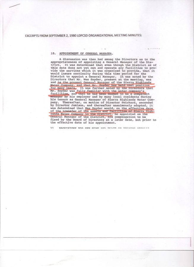
CPUC TRANSFER APPROVAL AND THE LDPCSD FORMATION

Reading the California Public Utilities Commission [CPUC] approval of the transfer of facilities and assets from Sierra Highlands Water Company to the LDPCSD clearly indicates that our SURFACE WATER TREATMENT PLANT was specifically created to serve the LDP residential subdivision, however, properties  already receiving water from Sierra Highlands would be accepted into the new LDPCSD as well.  Sounds fair huh?

EXISTING CUSTOMERS?

There’s the rub.  This (apparently) is where the “SHIT HIT THE FAN” because there were many thirsty property owners and speculative land developers all around the new LDP residential subdivision claiming prior existing and promised water service. [This was also addressed in the transfer by Sierra Highlands – ANYTHING not specifically detailed in that transfer agreement was not to be passed on to the new LDPCSD public agency.]

SIGNIFICANT NOTE: Extremely important CPUC transfer language was apparently changed by DISTRICT PERSONNEL to expand the water service area and include properties clearly not entitled and this DISINFORMATION was inserted into our LDPCSD historical records!  And so the fraud began with the fabrication of a legitimate document.  Shame shame shame.


 Decades of LIES!


IS FABRICATION OF PUBLIC RECORDS STILL A CRIME?  Undoubtedly this fabricated document was also used as evidence from time to time before other unknowing (or playing dumb) authorizing/permitting individuals/governmental entities.

IF A PICTURE CAN BE WORTH A THOUSAND WORDS –

A FAKE MAP CAN BE WORTH MILLIONS OF DOLLARS!


Later the LDPCSD purchased high priced color plotting equipment and software (without appropriate certification or training) to quickly MANUFACTURE THEIR OWN GIS (Geographic Information System) MAPS WHICH DID NOT NECESSARILY DOCUMENT LEGAL BOUNDARIES, but rather, where the LDPCSD (those in charge at the time) desired to provide expanded water service.  Many of these maps have been repeatedly copied and modified for various purposes to the point they are laughable as any sort of evidence.


One thing that has always struck me as peculiar about many LDPCSD maps – and a definite warning sign as to authenticity, was how such purported OFFICIAL MAPS rarely had a date, identity of the issuing authority, or other relevant information (usually contained in a title block) such as number of revisions, compass heading and scale. If not for the fact these activities were so serious and damaging to others – what this district has produced and attempted to pass off as “evidence” is laughable.

WHY IS DIRECTOR ROSS SO INVOLVED IN THE MID POU?.

When Boise Cascade was constructing the LDP residential subdivision water infrastructure in the 1960s, they discovered another water tank site was needed to maintain correct pressure and flow in the northeastern portion of the development.  Ultimately, the Sturtevant Ranch owners agreed to provide the land and easements necessary for the “STURTEVANT TANK” in exchange for 10 water meters that could be used by that ranch in a designated area in the future.   Documents were recorded with the LDPCSD and substantiated the fact 10 water meters were on the “Sturtevant Ranch account”.  With me so far?

When Emery Ross came to this area (early 1990s) and purchased his ranch property he was clearly advised by the seller (Sturtevant Ranch owners) Emery had no right to a water meter.  Ross purchased the property anyway but then attempted multiple times to obtain service but the LDPCSD steadfastly refused.  He was clearly out of the MID POU service area.

Several years later a Sturtevant family member attended a LDPCSD meeting and discovered Emery Ross had somehow obtained one of the ranch’s water meters (obviously with some sort of assistance from LDPCSD personnel).

STURTEVANT RANCH LETTER

This prompted an investigation which revealed there were several other properties which had also WRONGFULLY obtained these STURTEVANT RANCH water meters along with a FALSE WATER SERVICE ACQUISTION DATES – which I believe still remain.  (Dating back to the residential subdivision development.)

CAUGHT – BUT NO METER REMOVALS

Even though the wrongful acquisition of these water meters was eventually discovered (RECORDS IN THE OFFICE WERE MISSING/COULDN”T BE FOUND – another BIG CLUE) the water service was never discontinued so these OUTSIDE MERCED IRRIGATION PLACE OF USE PROPERTIES had to be furnished GROUNDWATER from our (at the time) only emergency groundwater well, along with all the other properties (35-36 total – including Emery Ross’s commercial cattle ranching operation).

For decades other outside MID POU property owners have tried to get water service (who can blame them for that? – whether a single home, cattle ranch, or a subdivision – in these drought prone foothills everyone wants water – but they want someone else to be “ON THE HOOK” if an expensive ground well fails) but were denied due to the GROUNDWATER SUBSTITUTION PROGRAM requiring construction of many more extremely expensive groundwater wells.

WHAT THE FRACK IS HAPPENING HERE?

Here is a small portion of the 40 pages of very confusing material presented by KAMPA:

“The LDPCSD has two different boundaries that were set by the Mariposa County Local Agency Formation Commission or LAFCO upon the formation of the District in 1980.

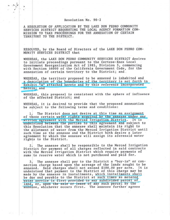
The District boundaries are the limits within which the district has the exclusive authority to provide the water and wastewater services for which the district was established.

The District boundaries were set based on the best available information in 1980 and have not since been amended.

The district “sphere of influence” boundaries is established by LAFCo as basically a planning area, outside the current district boundaries where logical additional expansion of our services may be necessary.

The attached district boundary and sphere of influence map shows nearly identical boundaries, with some very small variances.”


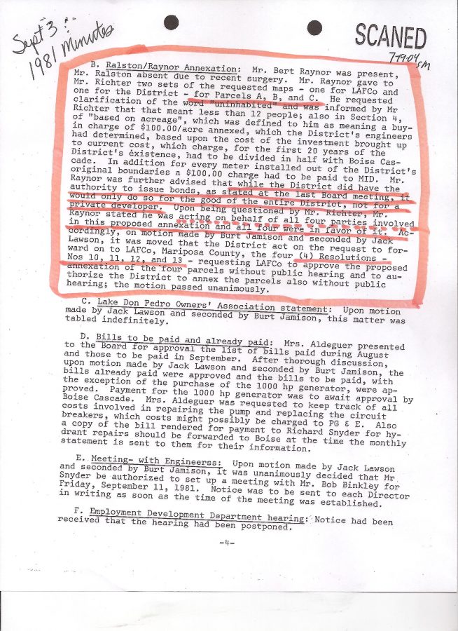
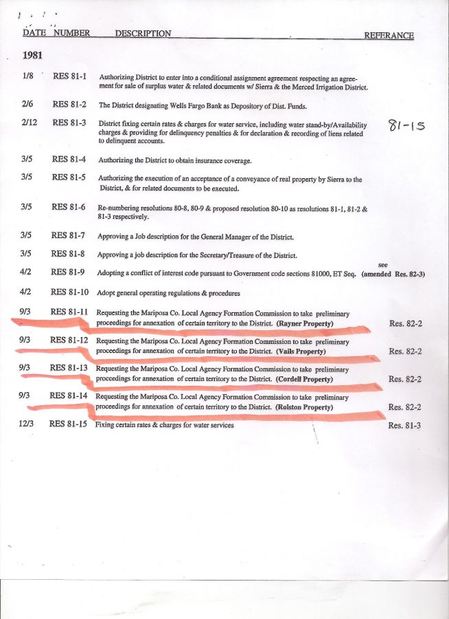
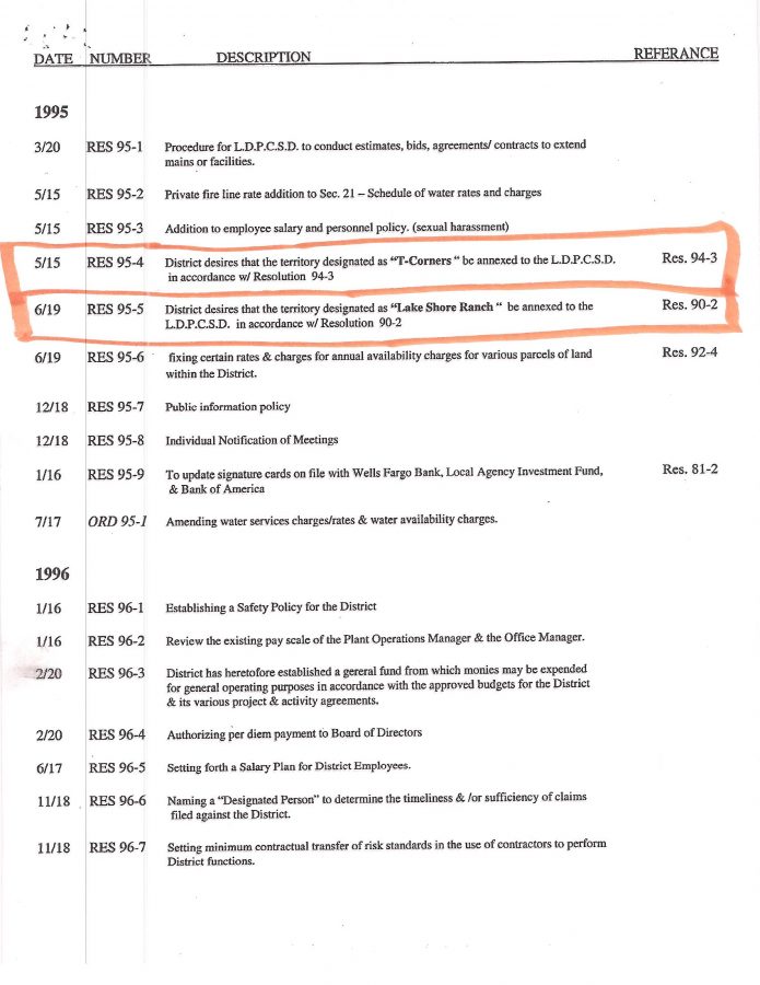
What?  The above certainly flies in the face of the numerous annexations to the district that Tuolumne/Mariposa County LAFCos made in the 1980’s and 1990’s. 

How could these properties be annexed into the district (one example I have provided on this site was IF the LDPCSD didn’t respond to a county request for response  the proposed project  could be DEFAULT APPROVED for lack of response! – https://lakedonpedro.org/01-time-line/maripco-planning-request-for-2006-154-comments/) if they were already within the district service boundaries created by LAFCo at formation in 1980 – according to PETE KAMPA’s report?

But how can Emery Ross receive water when his property was never even annexed by LAFCo?  Or the POE PROPERTY MULTI-METER CASE where neighboring APNs (Assessor Parcel Number) were used by a family to fraudulently obtain two more water meters for the same property! (Friend of Ross incidentally)

SIDE NOTE:  My understanding is there has only been ONE OFFICIAL ANNEXATION APPROVED BY THE SWRCB FOR OUR LDPCSD – that being South Shore for 2,010 acres and 772 af of MERCED RIVER WATER, but that never developed, is still “on the books”, and our district doesn’t receive a thin dime!


Well, the above information is way ahead of the video clip, but it is taking so long to upload/down load – just trying to get through the meeting.  Hopefully I can get caught up this weekend.


My best to you and yours, Lew


Categories: Uncategorized.

OPENING PUBLIC COMMENT (BEFORE THE MID POU DISCUSSION REALLY GOT INTERESTING – coming up later)

I am really frustrated and tired – all sorts of work to do at home but the information Kampa provided at the last meeting regarding LAFCo involvement in the LDPCSD water service boundaries makes no sense at all….UNLESS…..IT IS FACTUAL, but that would make past district activities I already believe to be irresponsible and reprehensible public service even more egregious and fraudulent.  But it sure might explain why there has NEVER BEEN AN OFFICIAL DISTRICT SERVICE MAP!  (But I’m getting ahead of the chronological reporting of the meeting- sorry.)  I think focusing on this MID POU issue is most important right now.

Here’s the fist video offering with some highlights (the new software took waaaaaaay to long to upload and download – need to find out why.  Think the clarity is any better?  Maybe shorter clips?)

Later, Lew


Categories: Uncategorized.